Soldotna, Alaska Map and Directory
Regional Directory > States Menu > Alaska
 According to the United States Census Bureau, Soldotna is a City that is located in Kenai Peninsula County, Alaska at 60.49 degrees North and 151.06 degrees West.
The city's time zone is America/Anchorage, and the city's primary telephone area code is 907.
The land area of Soldotna is about 6.90 square miles, whereas the water area of the city is about 0.44 square miles.
Kenai Peninsula County's land area is about 16,075 square miles, so the city occupies about 0.0 percent of the county's total land area.
According to the United States Census Bureau, Soldotna is a City that is located in Kenai Peninsula County, Alaska at 60.49 degrees North and 151.06 degrees West.
The city's time zone is America/Anchorage, and the city's primary telephone area code is 907.
The land area of Soldotna is about 6.90 square miles, whereas the water area of the city is about 0.44 square miles.
Kenai Peninsula County's land area is about 16,075 square miles, so the city occupies about 0.0 percent of the county's total land area.
The Census Bureau estimates that Soldotna had about 4,445 residents in 2014, which is approximately 644 people per square mile of land area.
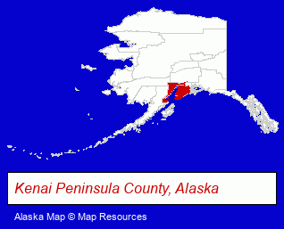
The Alaska counties map at upper right shows Kenai Peninsula County, highlighted in red. Use the menu below to display interactive maps of Soldotna, either in a frame on this page or in full-screen mode.
Use the menu below to display categorized Soldotna directories.
| Soldotna Products and Services Directory | ||
|---|---|---|
| Clothing Stores | Hunting | Schools |
| Vacation Home Rental | ||
Selected Soldotna, Alaska Listings
These randomly selected Soldotna listings provide some insight into the city's cultural environment and economic climate.- Public Golf Courses
- Vacation Home Rental
- Cabin, Cottage & Chalet Rental
- Cabin, Cottage & Chalet Rental
- Tours & Charters
- Hunting
- Fishing Guides & Charters
- Hunting Guides
- Hunting & Fishing Outfitters
- Grocery Stores & Supermarkets
- Veterinarians
- Animal Hospitals
- Building & Home Construction
- Builders & Contractors
- Excavation Contractors
- Clinics & Medical Centers
- Animal Hospitals
Nearby Alaska Cities and Towns *
- Anchorage (54) - Anchorage, Alaska products & services directory.
- Fairbanks (16) - Fairbanks, Alaska demographics and directory.
- Homer (4) - Homer, Alaska information and maps.
- Kenai (1) - Kenai, Alaska information and maps.
- Palmer (3) - Palmer, Alaska information and maps.
- Seward (2) - Seward, Alaska information and maps.
- Wasilla (5) - Wasilla, Alaska demographics and maps.
* Parenthesized numbers indicate economic activity levels.
Copyright © 2011-2026 RegionalDirectory.us. All rights reserved.