Jonesboro, Arkansas Map and Directory
Regional Directory > States Menu > Arkansas
 According to the United States Census Bureau, Jonesboro is a City that is located in Craighead County, Arkansas at 35.84 degrees North and 90.70 degrees West.
The city's time zone is America/Chicago, and the city's primary telephone area code is 870.
The land area of Jonesboro is about 80.33 square miles, whereas the water area of the city is about 0.60 square miles.
Craighead County's land area is about 707 square miles, so the city occupies about 11.4 percent of the county's total land area.
According to the United States Census Bureau, Jonesboro is a City that is located in Craighead County, Arkansas at 35.84 degrees North and 90.70 degrees West.
The city's time zone is America/Chicago, and the city's primary telephone area code is 870.
The land area of Jonesboro is about 80.33 square miles, whereas the water area of the city is about 0.60 square miles.
Craighead County's land area is about 707 square miles, so the city occupies about 11.4 percent of the county's total land area.
The Census Bureau estimates that Jonesboro had about 78,394 residents in 2019, which is approximately 976 people per square mile of land area.
According to recent American Community Survey data, the median household income in Jonesboro was about $45,931 per year.
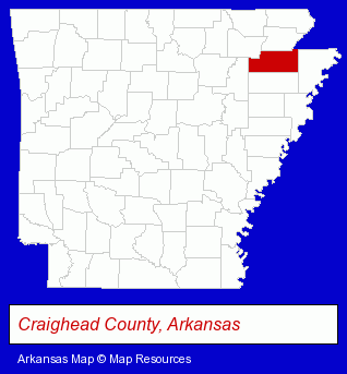
The Arkansas counties map at upper right shows Craighead County, highlighted in red. Use the menu below to display interactive maps of Jonesboro, either in a frame on this page or in full-screen mode.
Use the menu below to display categorized Jonesboro directories.
| Jonesboro Products and Services Directory | ||
|---|---|---|
| Attorneys | Auto Service | Building Materials |
| Business Services | Clinics | Clothing Stores |
| Embroidery | Embroidery Services | Home Improvement |
| Insurance | Printing and Publishing | |
Selected Jonesboro, Arkansas Listings
These randomly selected Jonesboro listings provide some insight into the city's cultural environment and economic climate.- Electric & Electronic Equipment & Supplies
- Consumer Electronics Stores
- Electric Equipment & Supplies Wholesale & Manufacturers
- Lighting Retail
- Building Materials & Supplies Wholesale & Manufacturers
- Medical Equipment & Supplies Retail
- Plastic & Plastic Products Wholesale & Manufacturers
- Medical Equipment & Supplies Wholesale & Manufacturers
- Government Offices
- County Government
- Local Government
- Law Enforcement
- Motorcycle, Motor Scooter & Minibike Dealers
- Corporate Business Attorneys
- Personal Injury Attorneys
- Social Security Attorneys
- Administrative & Governmental Law Attorneys
- Sports & Recreation Clubs & Organizations
- Country Clubs
- Shopping Centers & Malls
- Department Stores
- Truck Dealers
- Used Cars
- Used Trucks
- Hospitals
- Visual Arts
- Other Schools & Instruction
- Crafts Instruction & Schools
- Ceramic Studios, Equipment & Supplies Retail
- Pottery Instruction
- Civic Clubs & Organizations
- Public Golf Courses
- Sports & Recreation Clubs & Organizations
- Country Clubs
- Private Clubs
- Used Clothing Retail
Nearby Arkansas Cities and Towns *
- Conway (6) - Conway, Arkansas demographics and maps.
- Fayetteville (14) - Fayetteville, Arkansas demographics and directory.
- Heber Springs (1) - Heber Springs, Arkansas information and maps.
- Little Rock (32) - Little Rock, Arkansas solutions directory and maps.
- Mountain Home (6) - Mountain Home, Arkansas demographics and maps.
- Searcy (2) - Searcy, Arkansas information and maps.
* Parenthesized numbers indicate economic activity levels.
Copyright © 2011-2026 RegionalDirectory.us. All rights reserved.