Chandler, Arizona Map and Directory
Regional Directory > States Menu > Arizona
 According to the United States Census Bureau, Chandler is a City that is located in Maricopa County, Arizona at 33.31 degrees North and 111.84 degrees West.
The city's time zone is America/Phoenix, and the city's primary telephone area code is 480.
The land area of Chandler is about 64.79 square miles, whereas the water area of the city is about 0.10 square miles.
Maricopa County's land area is about 9,200 square miles, so the city occupies about 0.7 percent of the county's total land area.
According to the United States Census Bureau, Chandler is a City that is located in Maricopa County, Arizona at 33.31 degrees North and 111.84 degrees West.
The city's time zone is America/Phoenix, and the city's primary telephone area code is 480.
The land area of Chandler is about 64.79 square miles, whereas the water area of the city is about 0.10 square miles.
Maricopa County's land area is about 9,200 square miles, so the city occupies about 0.7 percent of the county's total land area.
The Census Bureau estimates that Chandler had about 261,165 residents in 2019, which is approximately 4,031 people per square mile of land area.
According to recent American Community Survey data, the median household income in Chandler was about $82,925 per year.
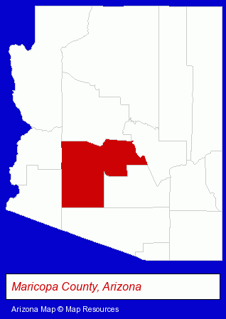
The Arizona counties map at upper right shows Maricopa County, highlighted in red. Use the menu below to display interactive maps of Chandler, either in a frame on this page or in full-screen mode.
Use the menu below to display categorized Chandler directories.
| Chandler Products and Services Directory | ||
|---|---|---|
| Auto Service | Building Materials | Chiropractors |
| Dentists | Financial Services | Home Improvement |
| Physicians | Restaurants | Schools |
Selected Chandler, Arizona Listings
These randomly selected Chandler listings provide some insight into the city's cultural environment and economic climate.- Advertising
- Sign Dealers
- Commercial Signs
- Neon Signs
- Pest Control Services
- Bee Control & Removal Services
- Elementary & Secondary Education
- Elementary Schools
- Ophthalmology Physicians & Surgeons
- Cosmetic & Reconstructive Surgeons
- Computer Printers
- Computer Supplies, Parts & Accessories
- Elementary & Secondary Education
- Elementary Schools
- Preschools & Kindergartens
- Towing
- Elementary & Secondary Education
- Elementary Schools
- Legal Services
- Court Reporting
- Court & Convention Reporters
- Metals
- Trailer Service & Repair
- Water Filtration Equipment Retail
- Truck Dealers
- Used Cars
- Used Trucks
- Industrial Equipment & Supplies Dealers
- Industrial Equipment & Supplies Wholesale & Manufacturers
- Electronic Equipment & Supplies Retail
- Electronic Components Retail
- Truck Dealers
- Forklift & Industrial Truck Dealers
- Japanese Restaurants
- Accounting, Auditing & Bookkeeping Services
- Tax Return Preparation
- Tax Return Preparation & Electronic Filing
Nearby Arizona Cities and Towns *
- Apache Junction (1) - Apache Junction, Arizona information and maps.
- Gilbert (14) - Gilbert, Arizona demographics and directory.
- Glendale (15) - Glendale, Arizona demographics and directory.
- Mesa (40) - Mesa, Arizona products & services directory.
- Phoenix (149) - Phoenix, Arizona products & services directory.
- Scottsdale (57) - Scottsdale, Arizona products & services directory.
- Tempe (36) - Tempe, Arizona products & services directory.
* Parenthesized numbers indicate economic activity levels.
Copyright © 2011-2026 RegionalDirectory.us. All rights reserved.