Capitola, California Map and Directory
Regional Directory > States Menu > California
 According to the United States Census Bureau, Capitola is a City that is located in Santa Cruz County, California at 36.98 degrees North and 121.95 degrees West.
The city's time zone is America/Los Angeles, and the city's primary telephone area code is 831.
The land area of Capitola is about 1.59 square miles, whereas the water area of the city is about 0.08 square miles.
Santa Cruz County's land area is about 445 square miles, so the city occupies about 0.4 percent of the county's total land area.
According to the United States Census Bureau, Capitola is a City that is located in Santa Cruz County, California at 36.98 degrees North and 121.95 degrees West.
The city's time zone is America/Los Angeles, and the city's primary telephone area code is 831.
The land area of Capitola is about 1.59 square miles, whereas the water area of the city is about 0.08 square miles.
Santa Cruz County's land area is about 445 square miles, so the city occupies about 0.4 percent of the county's total land area.
The Census Bureau estimates that Capitola had about 10,010 residents in 2019, which is approximately 6,296 people per square mile of land area.
According to recent American Community Survey data, the median household income in Capitola was about $71,059 per year.
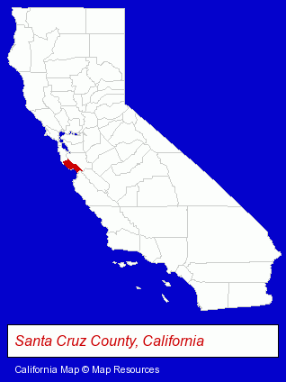
The California counties map at upper right shows Santa Cruz County, highlighted in red. Use the menu below to display interactive maps of Capitola, either in a frame on this page or in full-screen mode.
Use the menu below to display categorized Capitola directories.
| Capitola Products and Services Directory | ||
|---|---|---|
| Gift Shops | Restaurants | Steak Restaurants |
Selected Capitola, California Listings
These representative Capitola listings provide some insight into the city's cultural environment and economic climate.- Movers
- Household Goods & Furniture Storage
- Lodging
- Hotels
- Motels
- Resorts & Vacation Cottages
- Government Contractors
- Excavation Contractors
- Tree Services Commercial & Industrial
- Land Clearing & Leveling Contractors
- Jewelers
- Pottery Retail
- Building Contractors
- Construction Companies
- American Restaurants
- Take Out
- Family Restaurants
- Fast Food Restaurants
- Insurance
- Financial Planning Consultants & Services
- Employment
- Human Resources
- Employment Preparation Services
- Career & Vocational Counseling
- Physicians & Surgeons
- Alternative Medicine
- Nutrition
- Housewares Stores
- Gift Baskets & Packs Retail
- Kitchenware & Glassware Retail
- Kitchen Gifts & Accessories
- Housewares Stores
- Schools
- Adult & Continuing Education
- Career & Workplace Education
- Management Development Training
- Physicians & Surgeons
- Family & General Practice Physicians & Surgeons
- Bar & Grill Restaurants
- Toy Stores
- Hobby & Model Stores
- American Restaurants
- Building & Home Construction
- Special Trades Contractors
- Electric Contractors
Nearby California Cities and Towns *
- Aptos (3) - Aptos, California information and maps.
- Campbell (17) - Campbell, California solutions directory and maps.
- Felton (2) - Felton, California information and maps.
- Los Gatos (11) - Los Gatos, California demographics and directory.
- Santa Cruz (42) - Santa Cruz, California products & services directory.
- Saratoga (2) - Saratoga, California information and maps.
- Watsonville (6) - Watsonville, California demographics and maps.
* Parenthesized numbers indicate economic activity levels.
Copyright © 2011-2026 RegionalDirectory.us. All rights reserved.