Dana Point, California Map and Directory
Regional Directory > States Menu > California
 According to the United States Census Bureau, Dana Point is a City that is located in Orange County, California at 33.47 degrees North and 117.70 degrees West.
The city's time zone is America/Los Angeles, and the city's primary telephone area code is 949.
The land area of Dana Point is about 6.50 square miles, whereas the water area of the city is about 22.98 square miles.
Orange County's land area is about 791 square miles, so the city occupies about 0.8 percent of the county's total land area.
According to the United States Census Bureau, Dana Point is a City that is located in Orange County, California at 33.47 degrees North and 117.70 degrees West.
The city's time zone is America/Los Angeles, and the city's primary telephone area code is 949.
The land area of Dana Point is about 6.50 square miles, whereas the water area of the city is about 22.98 square miles.
Orange County's land area is about 791 square miles, so the city occupies about 0.8 percent of the county's total land area.
The Census Bureau estimates that Dana Point had about 33,577 residents in 2019, which is approximately 5,166 people per square mile of land area.
According to recent American Community Survey data, the median household income in Dana Point was about $99,409 per year.
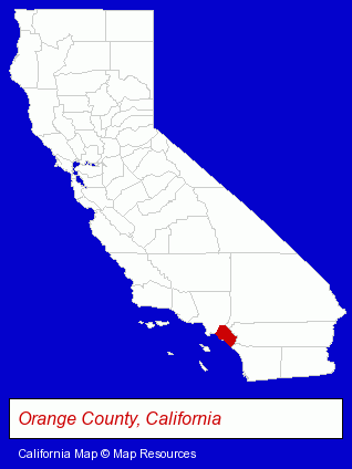
The California counties map at upper right shows Orange County, highlighted in red. Use the menu below to display interactive maps of Dana Point, either in a frame on this page or in full-screen mode.
Use the menu below to display categorized Dana Point directories.
| Dana Point Products and Services Directory | |
|---|---|
| Business Services | Restaurants |
Selected Dana Point, California Listings
These representative Dana Point listings provide some insight into the city's cultural environment and economic climate.- Air Conditioning Contractors
- Heating Equipment & Systems Dealers
- Bakeries
- Information Technology Services
- Internet Products & Services
- Web Site Design
- Web Sites
- Visual Arts
- Art Galleries & Dealers
- Coffee & Tea Shops
- Arcades & Amusements
- Boat & Yacht Charters, Rental & Leasing
- Marinas
- Bar & Grill Restaurants
- Seafood Restaurants
- Weddings
- Bakeries
- Accountants
- Certified Public Accountants
- Clinics & Medical Centers
- Clinics
- Airline Tickets
- Attorneys
- Corporate Business Attorneys
- Legal Services
- Financial Services
- Real Estate Agencies & Brokerage
- Real Estate Appraisers
- Landscape Contractors
- Landscape Services
- Landscape Designers & Consultants
- Landscape Architects
Nearby California Cities and Towns *
- Aliso Viejo (5) - Aliso Viejo, California demographics and maps.
- Laguna Beach (9) - Laguna Beach, California demographics and directory.
- Laguna Hills (15) - Laguna Hills, California demographics and directory.
- Laguna Niguel (5) - Laguna Niguel, California demographics and maps.
- Mission Viejo (20) - Mission Viejo, California solutions directory and maps.
- San Clemente (9) - San Clemente, California demographics and directory.
- San Juan Capistrano (6) - San Juan Capistrano, California demographics and maps.
* Parenthesized numbers indicate economic activity levels.
Copyright © 2011-2026 RegionalDirectory.us. All rights reserved.