La Habra, California Map and Directory
Regional Directory > States Menu > California
 According to the United States Census Bureau, La Habra is a City that is located in Orange County, California at 33.93 degrees North and 117.95 degrees West.
The city's time zone is America/Los Angeles, and the city's primary telephone area code is 562.
The land area of La Habra is about 7.35 square miles, whereas the water area of the city is about 0.01 square miles.
Orange County's land area is about 791 square miles, so the city occupies about 0.9 percent of the county's total land area.
According to the United States Census Bureau, La Habra is a City that is located in Orange County, California at 33.93 degrees North and 117.95 degrees West.
The city's time zone is America/Los Angeles, and the city's primary telephone area code is 562.
The land area of La Habra is about 7.35 square miles, whereas the water area of the city is about 0.01 square miles.
Orange County's land area is about 791 square miles, so the city occupies about 0.9 percent of the county's total land area.
The Census Bureau estimates that La Habra had about 60,513 residents in 2019, which is approximately 8,233 people per square mile of land area.
According to recent American Community Survey data, the median household income in La Habra was about $79,325 per year.
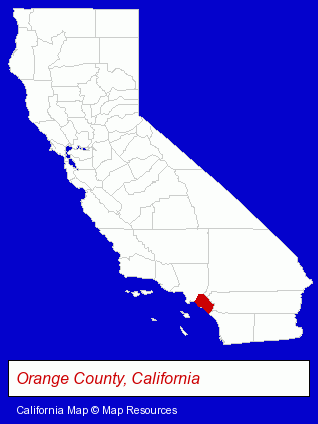
The California counties map at upper right shows Orange County, highlighted in red. Use the menu below to display interactive maps of La Habra, either in a frame on this page or in full-screen mode.
Use the menu below to display categorized La Habra directories.
| La Habra Products and Services Directory | ||
|---|---|---|
| Auto Service | Home Improvement | Moving and Storage |
Selected La Habra, California Listings
These representative La Habra listings provide some insight into the city's cultural environment and economic climate.- Packaging & Shipping Materials Retail
- Auto Emissions Testing & Repair
- Dentists
- Cosmetic Dentists
- Drug Stores & Pharmacies
- Metals
- Jewelers
- Clothing & Accessories Wholesale & Manufacturers
- Metal Finishing
- Jewelry Wholesale & Manufacturers
- Builders & Contractors
- Building Contractors
- Moving & Storage Commercial & Industrial
- Moving & Storage Equipment & Supplies Retail
- Boxes & Bags Retail
- Corrugated & Fiber Boxes Retail
- Beverages Retail
- Cemeteries & Memorial Parks
- Cemeteries & Crematories
- Cremation Services
- Kitchen & Bathroom Remodeling
- Cabinet Dealers
- Kitchen Fixtures & Accessories Dealers
- Kitchen Cabinets & Equipment Dealers
Nearby California Cities and Towns *
- Anaheim (42) - Anaheim, California products & services directory.
- Brea (10) - Brea, California demographics and directory.
- Buena Park (3) - Buena Park, California information and maps.
- Fullerton (13) - Fullerton, California demographics and directory.
- Hacienda Heights (1) - Hacienda Heights, California information and maps.
- La Puente (2) - La Puente, California information and maps.
- Whittier (4) - Whittier, California information and maps.
* Parenthesized numbers indicate economic activity levels.
Copyright © 2011-2026 RegionalDirectory.us. All rights reserved.