Lawndale, California Map and Directory
Regional Directory > States Menu > California
 According to the United States Census Bureau, Lawndale is a City that is located in Los Angeles County, California at 33.89 degrees North and 118.35 degrees West.
The city's time zone is America/Los Angeles, and the city's primary telephone area code is 424.
The land area of Lawndale is about 1.97 square miles, whereas the water area of the city is about 0.00 square miles.
Los Angeles County's land area is about 4,058 square miles, so the city occupies about 0.0 percent of the county's total land area.
According to the United States Census Bureau, Lawndale is a City that is located in Los Angeles County, California at 33.89 degrees North and 118.35 degrees West.
The city's time zone is America/Los Angeles, and the city's primary telephone area code is 424.
The land area of Lawndale is about 1.97 square miles, whereas the water area of the city is about 0.00 square miles.
Los Angeles County's land area is about 4,058 square miles, so the city occupies about 0.0 percent of the county's total land area.
The Census Bureau estimates that Lawndale had about 32,389 residents in 2019, which is approximately 16,441 people per square mile of land area.
According to recent American Community Survey data, the median household income in Lawndale was about $62,013 per year.
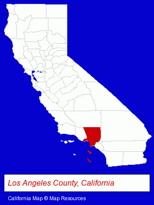
The California counties map at upper right shows Los Angeles County, highlighted in red. Use the menu below to display interactive maps of Lawndale, either in a frame on this page or in full-screen mode.
Use the menu below to display categorized Lawndale directories.
| Lawndale Directory Page: | Auto Service |
|---|
Selected Lawndale, California Listings
These Lawndale listings provide some insight into the city's cultural environment and economic climate.- Auto Emissions Testing & Repair
- Cultural Attractions, Events & Facilities
- Libraries
- Insurance
- Auto Insurance
- Property & Casualty Insurance
- Property Management
- Property Maintenance
- Optometrists
- Security Systems & Services
- Police Equipment & Supplies
- Alternative Medicine
- Nutrition
- Food Products Retail
- Natural Healing Products & Services
- Health & Diet Foods Retail
- Home Improvement & Maintenance
- Building Materials & Supplies Dealers
- Home Improvement Stores
- Concrete & Concrete Products Dealers
- Ready-Mixed Concrete Dealers
Nearby California Cities and Towns *
- El Segundo (6) - El Segundo, California demographics and maps.
- Gardena (11) - Gardena, California demographics and directory.
- Hermosa Beach (2) - Hermosa Beach, California information and maps.
- Inglewood (1) - Inglewood, California information and maps.
- Manhattan Beach (3) - Manhattan Beach, California information and maps.
- Redondo Beach (11) - Redondo Beach, California demographics and directory.
- Torrance (33) - Torrance, California products & services directory.
* Parenthesized numbers indicate economic activity levels.
Copyright © 2011-2026 RegionalDirectory.us. All rights reserved.