Mount Shasta, California Map and Directory
Regional Directory > States Menu > California
 According to the United States Census Bureau, Mount Shasta is a City that is located in Siskiyou County, California at 41.31 degrees North and 122.31 degrees West.
The city's time zone is America/Los Angeles, and the city's primary telephone area code is 530.
The land area of Mount Shasta is about 3.77 square miles, whereas the water area of the city is about 0.00 square miles.
Siskiyou County's land area is about 6,278 square miles, so the city occupies about 0.1 percent of the county's total land area.
According to the United States Census Bureau, Mount Shasta is a City that is located in Siskiyou County, California at 41.31 degrees North and 122.31 degrees West.
The city's time zone is America/Los Angeles, and the city's primary telephone area code is 530.
The land area of Mount Shasta is about 3.77 square miles, whereas the water area of the city is about 0.00 square miles.
Siskiyou County's land area is about 6,278 square miles, so the city occupies about 0.1 percent of the county's total land area.
The Census Bureau estimates that Mount Shasta had about 3,285 residents in 2014, which is approximately 871 people per square mile of land area.
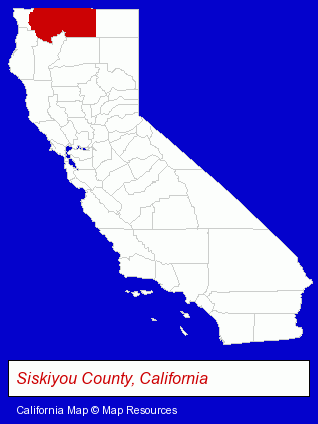
The California counties map at upper right shows Siskiyou County, highlighted in red. Use the menu below to display interactive maps of Mount Shasta, either in a frame on this page or in full-screen mode.
Use the menu below to display categorized Mount Shasta directories.
| Mount Shasta Directory Page: | Visual Arts |
|---|
Selected Mount Shasta, California Listings
These Mount Shasta listings provide some insight into the city's cultural environment and economic climate.- Government Contractors
- Art Galleries & Dealers
- Pictures & Prints Retail
- Attorneys
- Family Law Attorneys
- Estate Planning & Administration Attorneys
- Real Estate Attorneys
- Employment & Labor Law Attorneys
- Mexican Restaurants
- Lodging
- Hotels
- Motels
- Physicians & Surgeons
- Hearing Aids & Assistive Devices Retail
- Otolaryngology Physicians & Surgeons
- Management Consultants
- Business Management Services
- Security Systems & Services
- Investigation Services
- Security Consultants & Agencies
- Animal Shelters
- Office Supplies Retail
- Gift Shops
- Stationery Retail
- Religious Goods Stores
- Specialty Stores
- Art Galleries & Dealers
- Pictures & Prints Retail
Nearby California Cities and Towns *
- Anderson (1) - Anderson, California information and maps.
- Chico (26) - Chico, California solutions directory and maps.
- Eureka (5) - Eureka, California demographics and maps.
- Redding (31) - Redding, California solutions directory and maps.
Large and Mid-size Cities in Nearby States
- Ashland, Oregon (11) - Ashland, OR demographics and maps.
* Parenthesized numbers indicate economic activity levels.
Copyright © 2011-2026 RegionalDirectory.us. All rights reserved.