Murrieta, California Map and Directory
Regional Directory > States Menu > California
 According to the United States Census Bureau, Murrieta is a City that is located in Riverside County, California at 33.55 degrees North and 117.21 degrees West.
The city's time zone is America/Los Angeles, and the city's primary telephone area code is 951.
The land area of Murrieta is about 33.58 square miles, whereas the water area of the city is about 0.04 square miles.
Riverside County's land area is about 7,206 square miles, so the city occupies about 0.5 percent of the county's total land area.
According to the United States Census Bureau, Murrieta is a City that is located in Riverside County, California at 33.55 degrees North and 117.21 degrees West.
The city's time zone is America/Los Angeles, and the city's primary telephone area code is 951.
The land area of Murrieta is about 33.58 square miles, whereas the water area of the city is about 0.04 square miles.
Riverside County's land area is about 7,206 square miles, so the city occupies about 0.5 percent of the county's total land area.
The Census Bureau estimates that Murrieta had about 116,223 residents in 2019, which is approximately 3,461 people per square mile of land area.
According to recent American Community Survey data, the median household income in Murrieta was about $90,535 per year.
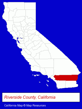
The California counties map at upper right shows Riverside County, highlighted in red. Use the menu below to display interactive maps of Murrieta, either in a frame on this page or in full-screen mode.
Use the menu below to display categorized Murrieta directories.
| Murrieta Products and Services Directory | ||
|---|---|---|
| Accountants | Air Conditioning | Animal Hospitals |
| Auto Service | Business Services | Dentists |
| Home Improvement | Physicians | Printing and Publishing |
| Restaurants | Veterinarians | Visual Arts |
Selected Murrieta, California Listings
These randomly selected Murrieta listings provide some insight into the city's cultural environment and economic climate.- Antiques
- Antique & Classic Auto Parts
- Alternative Medicine
- Chiropractors
- Auto Equipment & Supplies Retail
- Auto Paint
- Heating & Ventilating Contractors
- Carpet, Rug & Upholstery Cleaning
- Carpet, Rug & Upholstery Cleaning Commercial & Industrial
- Air Duct Cleaning
- Tiles Refinishing, Cleaning & Repair
- Major Appliance Service & Repair
- Refrigerator & Freezer Sales & Service
- Appliance Service & Repair
- Washing Machine & Dryer Service & Repair
- Printing Services
- Copying & Duplicating Services
- Printing Equipment & Supplies Dealers
- Management Consultants
- Business Management Services
- Property Management
- Auto Body Repair & Painting
- Collision Services
- Airport Transportation
- Certified Public Accountants
- Caterers
- Asphalt & Asphalt Products
- Paving Materials
Nearby California Cities and Towns *
- Fallbrook (2) - Fallbrook, California information and maps.
- Lake Elsinore (3) - Lake Elsinore, California information and maps.
- Moreno Valley (2) - Moreno Valley, California information and maps.
- Oceanside (14) - Oceanside, California demographics and directory.
- Rancho Santa Margarita (2) - Rancho Santa Margarita, California information and maps.
- Temecula (21) - Temecula, California solutions directory and maps.
- Vista (14) - Vista, California demographics and directory.
* Parenthesized numbers indicate economic activity levels.
Copyright © 2011-2026 RegionalDirectory.us. All rights reserved.