Santa Clarita, California Map and Directory
Regional Directory > States Menu > California
 According to the United States Census Bureau, Santa Clarita is a City that is located in Los Angeles County, California at 34.39 degrees North and 118.54 degrees West.
The city's time zone is America/Los Angeles, and the city's primary telephone area code is 661.
The land area of Santa Clarita is about 52.73 square miles, whereas the water area of the city is about 0.06 square miles.
Los Angeles County's land area is about 4,058 square miles, so the city occupies about 1.3 percent of the county's total land area.
According to the United States Census Bureau, Santa Clarita is a City that is located in Los Angeles County, California at 34.39 degrees North and 118.54 degrees West.
The city's time zone is America/Los Angeles, and the city's primary telephone area code is 661.
The land area of Santa Clarita is about 52.73 square miles, whereas the water area of the city is about 0.06 square miles.
Los Angeles County's land area is about 4,058 square miles, so the city occupies about 1.3 percent of the county's total land area.
The Census Bureau estimates that Santa Clarita had about 212,979 residents in 2019, which is approximately 4,039 people per square mile of land area.
According to recent American Community Survey data, the median household income in Santa Clarita was about $99,666 per year.
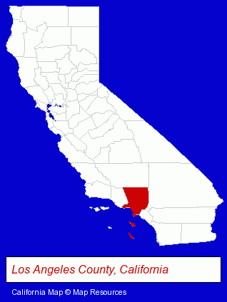
The California counties map at upper right shows Los Angeles County, highlighted in red. Use the menu below to display interactive maps of Santa Clarita, either in a frame on this page or in full-screen mode.
Use the menu below to display categorized Santa Clarita directories.
| Santa Clarita Products and Services Directory | ||
|---|---|---|
| Auto Service | Home Improvement | Moving and Storage |
| Restaurants | ||
Selected Santa Clarita, California Listings
These randomly selected Santa Clarita listings provide some insight into the city's cultural environment and economic climate.- Auto Transmissions
- Bicycle Dealers
- Motorcycle & Motor Scooter Parts Wholesale & Manufacturers
- Camps
- Tent Sales & Rental
- Department Stores
- Pet Food & Supplies Retail
- Pet Shops
- Zoos
- Zoo & Circus Animals
- Household Goods & Furniture Storage
- Warehouses & Warehousing
- Mini & Self Storage
- Printing & Publishing
- Concrete Contractors
- Concrete Contractors Commercial & Industrial
- Plumbing Contractors
- Plumbing Service & Repair
- Auto Parts Wholesale & Manufacturers
- Truck Equipment, Parts & Accessories Retail
- Truck Parts & Equipment Wholesale & Manufacturers
- Truck Body Dealers
- Government Contractors
- Packaging & Shipping Materials Retail
- American Restaurants
- Bar & Grill Restaurants
- Take Out
- Barbecue Restaurants
- Caterers
- Coffee & Tea Shops
- Home Furnishings Stores
- Furniture Stores
- Builders & Contractors
- Building Contractors
Nearby California Cities and Towns *
- Calabasas (3) - Calabasas, California information and maps.
- San Fernando (1) - San Fernando, California information and maps.
- Simi Valley (18) - Simi Valley, California solutions directory and maps.
- Thousand Oaks (15) - Thousand Oaks, California demographics and directory.
- West Hollywood (8) - West Hollywood, California demographics and maps.
- Westlake Village (12) - Westlake Village, California demographics and directory.
* Parenthesized numbers indicate economic activity levels.
Copyright © 2011-2026 RegionalDirectory.us. All rights reserved.