Stanton, California Map and Directory
Regional Directory > States Menu > California
 According to the United States Census Bureau, Stanton is a City that is located in Orange County, California at 33.80 degrees North and 117.99 degrees West.
The city's time zone is America/Los Angeles, and the city's primary telephone area code is 657.
The land area of Stanton is about 3.10 square miles, whereas the water area of the city is about 0.00 square miles.
Orange County's land area is about 791 square miles, so the city occupies about 0.4 percent of the county's total land area.
According to the United States Census Bureau, Stanton is a City that is located in Orange County, California at 33.80 degrees North and 117.99 degrees West.
The city's time zone is America/Los Angeles, and the city's primary telephone area code is 657.
The land area of Stanton is about 3.10 square miles, whereas the water area of the city is about 0.00 square miles.
Orange County's land area is about 791 square miles, so the city occupies about 0.4 percent of the county's total land area.
The Census Bureau estimates that Stanton had about 38,139 residents in 2019, which is approximately 12,303 people per square mile of land area.
According to recent American Community Survey data, the median household income in Stanton was about $57,598 per year.
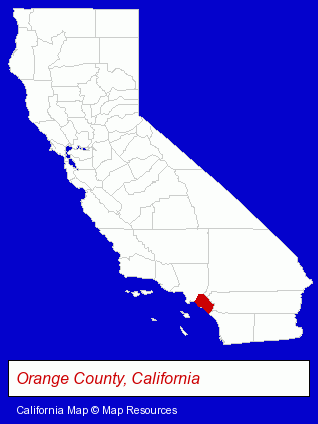
The California counties map at upper right shows Orange County, highlighted in red. Use the menu below to display interactive maps of Stanton, either in a frame on this page or in full-screen mode.
Use the menu below to display categorized Stanton directories.
| Stanton Directory Page: | Building Materials |
|---|
Selected Stanton, California Listings
These Stanton listings provide some insight into the city's cultural environment and economic climate.- Metals
- Metal Finishing
- Aircraft Parts & Equipment Retail
- Auto Service & Repair
- Heating & Air Conditioning Contractors
- Air Conditioning Service & Repair
- Art Galleries & Dealers
- Pictures & Prints Retail
- Plastic Molders
- Plastic Molds Manufacturers
- Bicycle Dealers
- Motorcycle, Motor Scooter & ATV Service & Repair
- Building & Home Construction
- Special Trades Contractors
- Painting Contractors
- Painting Contractors Commercial & Industrial
- Concrete & Concrete Products Dealers
- Masonry Equipment & Supplies
- Brick Dealers
- Concrete & Pumice Brick
- Building & Home Construction
- Builders & Contractors
- Building Contractors
- Construction Companies
- Home Improvement & Maintenance
- Plumbing Service & Repair
- Plumbing Drain & Sewer Consultants
- Building Materials & Supplies Wholesale & Manufacturers
- Electric & Electronic Equipment & Supplies
- Electric Equipment & Supplies Wholesale & Manufacturers
- Lighting Equipment & Systems Wholesale & Manufacturers
- Sports & Recreation Facilities
- Recreation Centers
- Restaurants
- Mexican Restaurants
- Energy & Environment
- Recycling Services, Equipment & Supplies
- Recycling Centers
- Printing & Publishing
- Printing Services
- Computer Printers
- Computer Supplies, Parts & Accessories
Nearby California Cities and Towns *
- Anaheim (42) - Anaheim, California products & services directory.
- Buena Park (3) - Buena Park, California information and maps.
- Fullerton (13) - Fullerton, California demographics and directory.
- Garden Grove (10) - Garden Grove, California demographics and directory.
- Los Alamitos (5) - Los Alamitos, California demographics and maps.
- Orange (39) - Orange, California products & services directory.
- Westminster (4) - Westminster, California information and maps.
* Parenthesized numbers indicate economic activity levels.
Copyright © 2011-2026 RegionalDirectory.us. All rights reserved.