Visalia, California Map and Directory
Regional Directory > States Menu > California
 According to the United States Census Bureau, Visalia is a City that is located in Tulare County, California at 36.33 degrees North and 119.29 degrees West.
The city's time zone is America/Los Angeles, and the city's primary telephone area code is 559.
The land area of Visalia is about 37.26 square miles, whereas the water area of the city is about 0.02 square miles.
Tulare County's land area is about 4,824 square miles, so the city occupies about 0.8 percent of the county's total land area.
According to the United States Census Bureau, Visalia is a City that is located in Tulare County, California at 36.33 degrees North and 119.29 degrees West.
The city's time zone is America/Los Angeles, and the city's primary telephone area code is 559.
The land area of Visalia is about 37.26 square miles, whereas the water area of the city is about 0.02 square miles.
Tulare County's land area is about 4,824 square miles, so the city occupies about 0.8 percent of the county's total land area.
The Census Bureau estimates that Visalia had about 134,605 residents in 2019, which is approximately 3,613 people per square mile of land area.
According to recent American Community Survey data, the median household income in Visalia was about $62,263 per year.
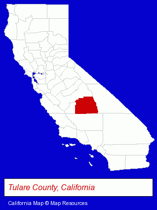
The California counties map at upper right shows Tulare County, highlighted in red. Use the menu below to display interactive maps of Visalia, either in a frame on this page or in full-screen mode.
Use the menu below to display categorized Visalia directories.
| Visalia Products and Services Directory | ||
|---|---|---|
| Accountants | Attorneys | Auto Service |
| Building Materials | Construction Companies | Home Improvement |
| Information Technology | Insurance | Physicians |
| Visual Arts | ||
Selected Visalia, California Listings
These randomly selected Visalia listings provide some insight into the city's cultural environment and economic climate.- Industrial Equipment & Supplies Dealers
- Auto Parts Wholesale & Manufacturers
- Notaries Public
- Osteopathic Physicians & Surgeons
- Internal Medicine Physicians & Surgeons
- Rheumatology Physicians & Surgeons
- Paving Contractors
- Trucking Companies
- Landscape Equipment & Supplies Dealers
- Construction Machinery & Equipment Dealers
- Concrete Construction Equipment & Supplies
- Boat Dealers
- Restaurants
- Caterers
- Criminal Law Attorneys
- Family Law Attorneys
- Trial Attorneys
- Civil Law Attorneys
- Building Contractors
- Construction Companies
- Industrial Equipment & Supplies Dealers
- Trucking Companies
- Clothing Wholesale & Manufacturers
- Safety Clothing & Equipment
- Clinics & Medical Centers
- Rehabilitation Services
- Rehabilitation Centers
- Alcohol & Drug Abuse Information & Treatment
- Addiction Information & Treatment
- Photography
- Professional Photographers
- Portrait Photographers
- Wedding Photography & Videos
- Certified Public Accountants
- Alternative Medicine
- Chiropractors
- Heating Equipment & Systems Dealers
- Plumbing & Heating Supplies Retail
Nearby California Cities and Towns *
- Bakersfield (49) - Bakersfield, California products & services directory.
- Clovis (6) - Clovis, California demographics and maps.
- Fresno (69) - Fresno, California products & services directory.
- Lemoore (1) - Lemoore, California information and maps.
- Porterville (1) - Porterville, California information and maps.
- Three Rivers (1) - Three Rivers, California information and maps.
- Tulare (1) - Tulare, California information and maps.
* Parenthesized numbers indicate economic activity levels.
Copyright © 2011-2026 RegionalDirectory.us. All rights reserved.