Bethel, Connecticut Map and Directory
Regional Directory > States Menu > Connecticut
 According to the United States Census Bureau, Bethel is a Town that is located in Fairfield County, Connecticut at 41.37 degrees North and 73.39 degrees West.
The town's time zone is America/New York, and the town's primary telephone area code is 203.
The land area of Bethel is about 16.89 square miles, whereas the water area of the town is about 0.04 square miles.
Fairfield County's land area is about 625 square miles, so the town occupies about 2.7 percent of the county's total land area.
According to the United States Census Bureau, Bethel is a Town that is located in Fairfield County, Connecticut at 41.37 degrees North and 73.39 degrees West.
The town's time zone is America/New York, and the town's primary telephone area code is 203.
The land area of Bethel is about 16.89 square miles, whereas the water area of the town is about 0.04 square miles.
Fairfield County's land area is about 625 square miles, so the town occupies about 2.7 percent of the county's total land area.
The Census Bureau estimates that Bethel had about 19,663 residents in 2019, which is approximately 1,164 people per square mile of land area.
According to recent American Community Survey data, the median household income in Bethel was about $101,968 per year.
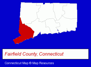
The Connecticut counties map at upper right shows Fairfield County, highlighted in red. Use the menu below to display interactive maps of Bethel, either in a frame on this page or in full-screen mode.
Use the menu below to display categorized Bethel directories.
| Bethel Products and Services Directory | ||
|---|---|---|
| Building Materials | Clothing Stores | Metals |
| Moving and Storage | Physicians | Restaurants |
| Security Systems | ||
Selected Bethel, Connecticut Listings
These randomly selected Bethel listings provide some insight into the town's cultural environment and economic climate.- Podiatry Physicians & Surgeons
- Banks
- Moving & Storage
- Security Systems & Services
- Specialty Movers
- Bank Equipment & Supplies
- Machine Shops
- Electronic Equipment & Supplies Wholesale & Manufacturers
- Metal Stamping
- Medical Equipment & Supplies Retail
- Machine Shops
- Industrial Equipment & Supplies Dealers
- Clothing Stores
- Medical Equipment & Supplies Retail
- Clothing Wholesale & Manufacturers
- Safety Clothing & Equipment
- Chemicals Wholesale & Manufacturers
- Lawn & Garden Equipment & Supplies Retail
- Nurseries
- Garden Centers
- Pizza Restaurants
- Sports & Recreation Facilities
- Health Clubs & Gyms
- Clothing & Accessories Wholesale & Manufacturers
- Jewelry Wholesale & Manufacturers
- Truck Dealers
- Soccer
Nearby Connecticut Cities and Towns *
- Brookfield (2) - Brookfield, Connecticut information and maps.
- Danbury (17) - Danbury, Connecticut solutions directory and maps.
- Monroe (3) - Monroe, Connecticut information and maps.
- Newtown (3) - Newtown, Connecticut information and maps.
- Ridgefield (6) - Ridgefield, Connecticut demographics and maps.
- Southbury (2) - Southbury, Connecticut information and maps.
- Wilton (5) - Wilton, Connecticut demographics and maps.
* Parenthesized numbers indicate economic activity levels.
Copyright © 2011-2026 RegionalDirectory.us. All rights reserved.