Plantsville, Connecticut Map and Directory
Regional Directory > States Menu > Connecticut
 According to the United States Census Bureau, Plantsville is a Census-designated Place that is located in Hartford County, Connecticut at 41.58 degrees North and 72.89 degrees West.
The place's time zone is America/New York, and the place's primary telephone area code is 959.
The land area of Plantsville is about 0.93 square miles, whereas the water area of the place is about 0.00 square miles.
Hartford County's land area is about 735 square miles, so the place occupies about 0.1 percent of the county's total land area.
According to the United States Census Bureau, Plantsville is a Census-designated Place that is located in Hartford County, Connecticut at 41.58 degrees North and 72.89 degrees West.
The place's time zone is America/New York, and the place's primary telephone area code is 959.
The land area of Plantsville is about 0.93 square miles, whereas the water area of the place is about 0.00 square miles.
Hartford County's land area is about 735 square miles, so the place occupies about 0.1 percent of the county's total land area.
The Census Bureau estimates that Plantsville had about 0 residents in 2014, which is approximately 0 people per square mile of land area.
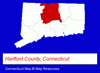
The Connecticut counties map at upper right shows Hartford County, highlighted in red. Use the menu below to display interactive maps of Plantsville, either in a frame on this page or in full-screen mode.
Use the menu below to display categorized Plantsville directories.
| Plantsville Directory Page: | Clinics |
|---|
Selected Plantsville, Connecticut Listings
These Plantsville listings provide some insight into the place's cultural environment and economic climate. Apple Valley Veterinarians - Herbert S Freiman DVM- Veterinarians
- Animal Hospitals
- Animal Health
- Clothing Stores
- Sportswear Retail
- Bowling Clothing Retail
- Bowling Equipment & Supplies Dealers
- Industrial Equipment & Supplies Dealers
- Industrial Equipment & Supplies Wholesale & Manufacturers
- Home Improvement & Maintenance
- Building Materials & Supplies Dealers
Nearby Connecticut Cities and Towns *
- Berlin (3) - Berlin, Connecticut information and maps.
- Bristol (8) - Bristol, Connecticut demographics and maps.
- Cheshire (6) - Cheshire, Connecticut demographics and maps.
- Meriden (7) - Meriden, Connecticut demographics and maps.
- New Britain (8) - New Britain, Connecticut demographics and maps.
- Plainville (3) - Plainville, Connecticut information and maps.
- Southington (3) - Southington, Connecticut information and maps.
* Parenthesized numbers indicate economic activity levels.
Copyright © 2011-2026 RegionalDirectory.us. All rights reserved.