Bradenton, Florida Map and Directory
Regional Directory > States Menu > Florida
 According to the United States Census Bureau, Bradenton is a City that is located in Manatee County, Florida at 27.50 degrees North and 82.57 degrees West.
The city's time zone is America/New York, and the city's primary telephone area code is 941.
The land area of Bradenton is about 14.28 square miles, whereas the water area of the city is about 2.72 square miles.
Manatee County's land area is about 743 square miles, so the city occupies about 1.9 percent of the county's total land area.
According to the United States Census Bureau, Bradenton is a City that is located in Manatee County, Florida at 27.50 degrees North and 82.57 degrees West.
The city's time zone is America/New York, and the city's primary telephone area code is 941.
The land area of Bradenton is about 14.28 square miles, whereas the water area of the city is about 2.72 square miles.
Manatee County's land area is about 743 square miles, so the city occupies about 1.9 percent of the county's total land area.
The Census Bureau estimates that Bradenton had about 59,439 residents in 2019, which is approximately 4,162 people per square mile of land area.
According to recent American Community Survey data, the median household income in Bradenton was about $46,776 per year.
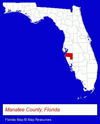
The Florida counties map at upper right shows Manatee County, highlighted in red. Use the menu below to display interactive maps of Bradenton, either in a frame on this page or in full-screen mode.
Use the menu below to display categorized Bradenton directories.
| Bradenton Products and Services Directory | ||
|---|---|---|
| Attorneys | Auto Service | Dentists |
| Garden Centers | Hair Removal | Home Improvement |
| Information Technology | Orthodontics Dentists | Personal Injury Attorneys |
| Physicians | Restaurants | Schools |
| Veterinarians | Visual Arts | |
Selected Bradenton, Florida Listings
These randomly selected Bradenton listings provide some insight into the city's cultural environment and economic climate.- Orthodontics Dentists
- Auto Accessories Retail
- Photography
- Professional Photographers
- Business Consultants & Advisors
- Information Technology Services
- Computer Consultants
- Network Consultants
- Information Systems Consultants
- Banks
- Private Golf Courses
- Collectibles Dealers
- Toy Stores
- Collectible Doll Dealers
- Business Services
- Business Consultants & Advisors
- Advertising
- Advertising Agencies & Consultants
- Advertising & Design Agencies
- Lawn & Garden Equipment & Supplies Retail
- Exporters
- Nurseries
- Garden Centers
- Retail Nurseries
- Prosthodontics Dentists
- Industrial Equipment & Supplies Dealers
- Estate Planning & Administration Attorneys
- Real Estate Attorneys
- Criminal Law Attorneys
- Family Law Attorneys
- Office Supplies Retail
- Office Furniture & Equipment Dealers
- Packaging & Shipping Materials Retail
- Labeling Equipment & Supplies
- Labels & Tags
- Neurology Physicians & Surgeons
- Window Glass Coating & Tinting
- Glass Coating & Tinting Commercial
- Auto Glass Coating & Tinting
- Landscape Contractors
- Landscape Services
- Landscape Designers & Consultants
- Landscape Equipment & Supplies Dealers
Nearby Florida Cities and Towns *
- Bradenton Beach (1) - Bradenton Beach, Florida information and maps.
- Clearwater (29) - Clearwater, Florida solutions directory and maps.
- Largo (12) - Largo, Florida demographics and directory.
- Pinellas Park (4) - Pinellas Park, Florida information and maps.
- Saint Petersburg (41) - Saint Petersburg, Florida products & services directory.
- Sarasota (50) - Sarasota, Florida products & services directory.
- Tampa (104) - Tampa, Florida products & services directory.
* Parenthesized numbers indicate economic activity levels.
Copyright © 2011-2026 RegionalDirectory.us. All rights reserved.