Brandon, Florida Map and Directory
Regional Directory > States Menu > Florida
 According to the United States Census Bureau, Brandon is a Census-designated Place that is located in Hillsborough County, Florida at 27.94 degrees North and 82.29 degrees West.
The place's time zone is America/New York, and the place's primary telephone area code is 813.
The land area of Brandon is about 33.10 square miles, whereas the water area of the place is about 1.89 square miles.
Hillsborough County's land area is about 1,020 square miles, so the place occupies about 3.2 percent of the county's total land area.
According to the United States Census Bureau, Brandon is a Census-designated Place that is located in Hillsborough County, Florida at 27.94 degrees North and 82.29 degrees West.
The place's time zone is America/New York, and the place's primary telephone area code is 813.
The land area of Brandon is about 33.10 square miles, whereas the water area of the place is about 1.89 square miles.
Hillsborough County's land area is about 1,020 square miles, so the place occupies about 3.2 percent of the county's total land area.
The Census Bureau estimates that Brandon had about 115,911 residents in 2019, which is approximately 3,502 people per square mile of land area.
According to recent American Community Survey data, the median household income in Brandon was about $61,120 per year.
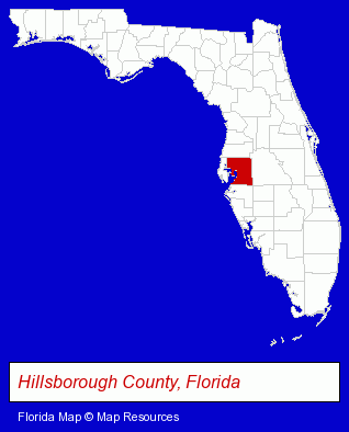
The Florida counties map at upper right shows Hillsborough County, highlighted in red. Use the menu below to display interactive maps of Brandon, either in a frame on this page or in full-screen mode.
Use the menu below to display categorized Brandon directories.
| Brandon Products and Services Directory | ||
|---|---|---|
| Attorneys | Clinics | Dentists |
| Home Improvement | Physicians | Veterinarians |
Selected Brandon, Florida Listings
These randomly selected Brandon listings provide some insight into the place's cultural environment and economic climate.- Libraries
- Public Libraries
- Periodontics Dentists
- Plumbing Contractors
- Plumbing Service & Repair
- Home Furnishings Stores
- Furniture Stores
- Tires Retail
- Wheel & Tire Service & Repair
- Pediatrics Physicians & Surgeons
- Group Medical Practice
- Allergy & Immunology Pediatrics Physicians & Surgeons
- Neonatology Physicians & Surgeons
- Sports & Recreation Facilities
- Bowling Alleys
- Pediatrics Physicians & Surgeons
Nearby Florida Cities and Towns *
- Lakeland (18) - Lakeland, Florida solutions directory and maps.
- Land O Lakes (3) - Land O Lakes, Florida information and maps.
- Odessa (2) - Odessa, Florida information and maps.
- Oldsmar (3) - Oldsmar, Florida information and maps.
- Plant City (3) - Plant City, Florida information and maps.
- Tampa (104) - Tampa, Florida products & services directory.
- Wesley Chapel (1) - Wesley Chapel, Florida information and maps.
* Parenthesized numbers indicate economic activity levels.
Copyright © 2011-2026 RegionalDirectory.us. All rights reserved.