Daytona Beach, Florida Map and Directory
Regional Directory > States Menu > Florida
 According to the United States Census Bureau, Daytona Beach is a City that is located in Volusia County, Florida at 29.21 degrees North and 81.02 degrees West.
The city's time zone is America/New York, and the city's primary telephone area code is 386.
The land area of Daytona Beach is about 58.41 square miles, whereas the water area of the city is about 5.36 square miles.
Volusia County's land area is about 1,101 square miles, so the city occupies about 5.3 percent of the county's total land area.
According to the United States Census Bureau, Daytona Beach is a City that is located in Volusia County, Florida at 29.21 degrees North and 81.02 degrees West.
The city's time zone is America/New York, and the city's primary telephone area code is 386.
The land area of Daytona Beach is about 58.41 square miles, whereas the water area of the city is about 5.36 square miles.
Volusia County's land area is about 1,101 square miles, so the city occupies about 5.3 percent of the county's total land area.
The Census Bureau estimates that Daytona Beach had about 69,186 residents in 2019, which is approximately 1,184 people per square mile of land area.
According to recent American Community Survey data, the median household income in Daytona Beach was about $35,893 per year.
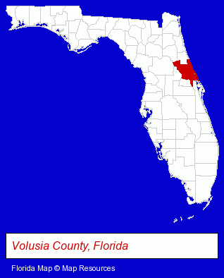
The Florida counties map at upper right shows Volusia County, highlighted in red. Use the menu below to display interactive maps of Daytona Beach, either in a frame on this page or in full-screen mode.
Use the menu below to display categorized Daytona Beach directories.
| Daytona Beach Products and Services Directory | ||
|---|---|---|
| Accountants | Air Transportation | Attorneys |
| Business Services | Clothing Stores | Embroidery |
| Embroidery Services | Financial Services | Home Improvement |
| Hotels | Information Technology | Printing and Publishing |
| Restaurants | Visual Arts | |
Selected Daytona Beach, Florida Listings
These randomly selected Daytona Beach listings provide some insight into the city's cultural environment and economic climate.- Aircraft Charter, Rental & Leasing
- Airlines
- Dentists
- Pest Control Services
- Office Supplies Retail
- Sign Dealers
- Signs Wholesale & Manufacturers
- Plastic & Plastic Products Wholesale & Manufacturers
- Travel Agents
- Travel Industry
- Cruise Lines & Agents
- Cruises Travel Agents
- Vocational Education
- Aviation Schools
- Travel Agents
- Travel Industry
- Air Transportation
- Cruise Lines & Agents
- Airline Tickets
- Building & Home Construction
- Special Trades Contractors
- Heating Contractors
- Heating & Ventilating Contractors
- Mechanical Contractors
- Medical Equipment & Supplies Retail
- Medical Equipment & Supplies Wholesale & Manufacturers
- Cultural Attractions, Events & Facilities
- Tourist Information & Attractions
- Museums
- Internet Products & Services
- Internet Services
- Internet Service Providers
- Legal Services
- Court Reporting
- Court & Convention Reporters
- Court Transcribers
- Property Management
- Shopping Centers & Malls
- Truck Equipment, Parts & Accessories Retail
Nearby Florida Cities and Towns *
- DeBary (2) - DeBary, Florida information and maps.
- DeLand (9) - DeLand, Florida demographics and directory.
- New Smyrna Beach (2) - New Smyrna Beach, Florida information and maps.
- Ormond Beach (6) - Ormond Beach, Florida demographics and maps.
- Palm Coast (1) - Palm Coast, Florida information and maps.
- Port Orange (3) - Port Orange, Florida information and maps.
- Sanford (7) - Sanford, Florida demographics and maps.
* Parenthesized numbers indicate economic activity levels.
Copyright © 2011-2026 RegionalDirectory.us. All rights reserved.