Homestead, Florida Map and Directory
Regional Directory > States Menu > Florida
 According to the United States Census Bureau, Homestead is a City that is located in Miami-Dade County, Florida at 25.47 degrees North and 80.48 degrees West.
The city's time zone is America/New York, and the city's primary telephone area code is 305.
The land area of Homestead is about 15.14 square miles, whereas the water area of the city is about 0.48 square miles.
Miami-Dade County's land area is about 1,898 square miles, so the city occupies about 0.8 percent of the county's total land area.
According to the United States Census Bureau, Homestead is a City that is located in Miami-Dade County, Florida at 25.47 degrees North and 80.48 degrees West.
The city's time zone is America/New York, and the city's primary telephone area code is 305.
The land area of Homestead is about 15.14 square miles, whereas the water area of the city is about 0.48 square miles.
Miami-Dade County's land area is about 1,898 square miles, so the city occupies about 0.8 percent of the county's total land area.
The Census Bureau estimates that Homestead had about 69,523 residents in 2019, which is approximately 4,592 people per square mile of land area.
According to recent American Community Survey data, the median household income in Homestead was about $47,508 per year.
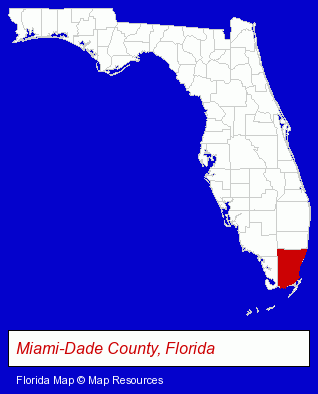
The Florida counties map at upper right shows Miami-Dade County, highlighted in red. Use the menu below to display interactive maps of Homestead, either in a frame on this page or in full-screen mode.
Use the menu below to display categorized Homestead directories.
| Homestead Products and Services Directory | |
|---|---|
| Clinics | Home Improvement |
Selected Homestead, Florida Listings
These representative Homestead listings provide some insight into the city's cultural environment and economic climate.- Clothing & Accessories Retail
- Jewelers
- Landscape Services
- Lawn & Garden Equipment & Supplies Retail
- Water Gardens, Fountains & Ponds
- Lawn & Garden Furnishings
- Landscape Contractors
- Landscape Services
- Landscape Designers & Consultants
- Landscape Contractors
- Landscape Services
- Landscape Designers & Consultants
- Lawn & Garden Services
- Lawn Services
- Corporate Business Attorneys
- Employment & Labor Law Attorneys
- Arbitration & Mediation Services
- Arbitration & Mediation Services Attorneys
- Educational Consultants
- Auto Parts Retail
- Importers
- Auto Tire Shop Equipment & Supplies
- Land Surveyors
- Surveyors
- Surveying Services
- Grading Contractors
- Clinics
- Building & Home Construction
- Builders & Contractors
- Construction Companies
- Information Technology Services
- Internet Products & Services
- Internet Services
- Internet Service Providers
- Computer Hardware & Supplies
- Nurseries
- Rehabilitation Services
- Rehabilitation Centers
- Nursing & Convalescent Homes
- Insurance
- Auto Insurance
- Health Insurance
- Property & Casualty Insurance
- Hospitalization Insurance
Nearby Florida Cities and Towns *
- Coral Gables (1) - Coral Gables, Florida information and maps.
- Hialeah (13) - Hialeah, Florida demographics and directory.
- Hollywood (23) - Hollywood, Florida solutions directory and maps.
- Islamorada (1) - Islamorada, Florida information and maps.
- Key Largo (5) - Key Largo, Florida demographics and maps.
- Miami (133) - Miami, Florida products & services directory.
- Miami Beach (17) - Miami Beach, Florida solutions directory and maps.
* Parenthesized numbers indicate economic activity levels.
Copyright © 2011-2026 RegionalDirectory.us. All rights reserved.