Palm Beach Gardens, Florida Map and Directory
Regional Directory > States Menu > Florida
 According to the United States Census Bureau, Palm Beach Gardens is a City that is located in Palm Beach County, Florida at 26.82 degrees North and 80.14 degrees West.
The city's time zone is America/New York, and the city's primary telephone area code is 561.
The land area of Palm Beach Gardens is about 56.03 square miles, whereas the water area of the city is about 0.24 square miles.
Palm Beach County's land area is about 1,970 square miles, so the city occupies about 2.8 percent of the county's total land area.
According to the United States Census Bureau, Palm Beach Gardens is a City that is located in Palm Beach County, Florida at 26.82 degrees North and 80.14 degrees West.
The city's time zone is America/New York, and the city's primary telephone area code is 561.
The land area of Palm Beach Gardens is about 56.03 square miles, whereas the water area of the city is about 0.24 square miles.
Palm Beach County's land area is about 1,970 square miles, so the city occupies about 2.8 percent of the county's total land area.
The Census Bureau estimates that Palm Beach Gardens had about 57,704 residents in 2019, which is approximately 1,030 people per square mile of land area.
According to recent American Community Survey data, the median household income in Palm Beach Gardens was about $87,969 per year.
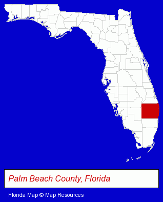
The Florida counties map at upper right shows Palm Beach County, highlighted in red. Use the menu below to display interactive maps of Palm Beach Gardens, either in a frame on this page or in full-screen mode.
Use the menu below to display categorized Palm Beach Gardens directories.
| Palm Beach Gardens Products and Services Directory | ||
|---|---|---|
| Attorneys | Business Services | Cosmetic Surgeons |
| Dentists | Financial Services | Physicians |
| Schools | ||
Selected Palm Beach Gardens, Florida Listings
These randomly selected Palm Beach Gardens listings provide some insight into the city's cultural environment and economic climate.- Accounting, Auditing & Bookkeeping Services
- Tax Return Preparation
- Tax Return Preparation & Electronic Filing
- Bookkeeping Services
- Business Consultants & Advisors
- Management Consultants
- Business Management Services
- Radio Sales & Service
- Veterinarians
- Emergency Services Veterinarians
- Small Animal Veterinarians
- Dentistry Veterinarians
- Corporate Business Attorneys
- Employment & Labor Law Attorneys
- Arbitration & Mediation Services
- Arbitration & Mediation Services Attorneys
- Internet Products & Services
- Web Site Design
- Web Sites
- Web Site Developers
- Criminal Law Attorneys
- Family Law Attorneys
- Divorce Attorneys
- Lodging
- Hotels
- Motels
- Hospitals
- Maxillofacial Physicians & Surgeons
- Clinics
- Dental Clinics
- Mental Health Clinics
- Orthodontics Dentists
- Cosmetic Dentists
- Pediatrics Dentists
- Drug Stores & Pharmacies
Nearby Florida Cities and Towns *
- Boynton Beach (9) - Boynton Beach, Florida demographics and directory.
- Hobe Sound (1) - Hobe Sound, Florida information and maps.
- Jupiter (13) - Jupiter, Florida demographics and directory.
- Lake Worth (4) - Lake Worth, Florida information and maps.
- North Palm Beach (2) - North Palm Beach, Florida information and maps.
- Palm Beach (3) - Palm Beach, Florida information and maps.
- West Palm Beach (56) - West Palm Beach, Florida products & services directory.
* Parenthesized numbers indicate economic activity levels.
Copyright © 2011-2026 RegionalDirectory.us. All rights reserved.