Panama City, Florida Map and Directory
Regional Directory > States Menu > Florida
 According to the United States Census Bureau, Panama City is a City that is located in Bay County, Florida at 30.16 degrees North and 85.66 degrees West.
The city's time zone is America/Chicago, and the city's primary telephone area code is 850.
The land area of Panama City is about 29.32 square miles, whereas the water area of the city is about 6.16 square miles.
Bay County's land area is about 758 square miles, so the city occupies about 3.9 percent of the county's total land area.
According to the United States Census Bureau, Panama City is a City that is located in Bay County, Florida at 30.16 degrees North and 85.66 degrees West.
The city's time zone is America/Chicago, and the city's primary telephone area code is 850.
The land area of Panama City is about 29.32 square miles, whereas the water area of the city is about 6.16 square miles.
Bay County's land area is about 758 square miles, so the city occupies about 3.9 percent of the county's total land area.
The Census Bureau estimates that Panama City had about 34,667 residents in 2019, which is approximately 1,182 people per square mile of land area.
According to recent American Community Survey data, the median household income in Panama City was about $43,953 per year.
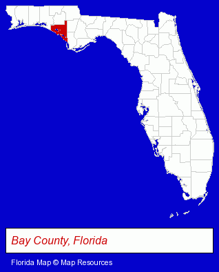
The Florida counties map at upper right shows Bay County, highlighted in red. Use the menu below to display interactive maps of Panama City, either in a frame on this page or in full-screen mode.
Use the menu below to display categorized Panama City directories.
| Panama City Products and Services Directory | ||
|---|---|---|
| Attorneys | Auto Service | Boat Dealers |
| Business Services | Clinics | Dentists |
| Fishing | Heating Contractors | Home Improvement |
| Insurance | Physicians | Restaurants |
| Schools | Visual Arts | Water Transportation |
Selected Panama City, Florida Listings
These randomly selected Panama City listings provide some insight into the city's cultural environment and economic climate.- Security Systems & Services
- Auto Locks & Lockout Services
- Rehabilitation Services
- Rehabilitation Centers
- Alcohol & Drug Abuse Information & Treatment
- Addiction Information & Treatment
- Corporate Business Attorneys
- Criminal Law Attorneys
- Family Law Attorneys
- Estate Planning & Administration Attorneys
- Lawn & Garden Services
- Lawn Services
- Auto Parts Retail
- Auto Parts Wholesale & Manufacturers
- Used & Rebuilt Auto Parts Retail
- Used & Rebuilt Auto Parts Wholesale & Manufacturers
- Clinics
- Orthopedics Physicians & Surgeons
- Homes & Residential Real Estate
- Corporate Business Attorneys
- Estate Planning & Administration Attorneys
- Real Estate Attorneys
- Cultural Attractions, Events & Facilities
- Tourist Information & Attractions
- Museums
- Pet Care Services
- Pet Grooming & Boarding
- Pet Sitting & Day Care
- Pet Grooming
- Office Supplies Retail
- Stationery Retail
- Urology Physicians & Surgeons
- Radiology Physicians & Surgeons
- Medical Diagnostic Services
- Medical Imaging
- Funeral Services
- Funeral Homes & Directors
- Cemeteries & Memorial Parks
- Cemeteries & Crematories
- Cremation Services
Nearby Florida Cities and Towns *
- Destin (10) - Destin, Florida demographics and directory.
- Fort Walton Beach (4) - Fort Walton Beach, Florida information and maps.
- Miramar Beach (3) - Miramar Beach, Florida information and maps.
- Panama City Beach (1) - Panama City Beach, Florida information and maps.
- Pensacola (33) - Pensacola, Florida products & services directory.
- Tallahassee (38) - Tallahassee, Florida products & services directory.
* Parenthesized numbers indicate economic activity levels.
Copyright © 2011-2026 RegionalDirectory.us. All rights reserved.