Port Charlotte, Florida Map and Directory
Regional Directory > States Menu > Florida
 According to the United States Census Bureau, Port Charlotte is a Census-designated Place that is located in Charlotte County, Florida at 26.98 degrees North and 82.09 degrees West.
The place's time zone is America/New York, and the place's primary telephone area code is 941.
The land area of Port Charlotte is about 28.48 square miles, whereas the water area of the place is about 3.86 square miles.
Charlotte County's land area is about 680 square miles, so the place occupies about 4.2 percent of the county's total land area.
According to the United States Census Bureau, Port Charlotte is a Census-designated Place that is located in Charlotte County, Florida at 26.98 degrees North and 82.09 degrees West.
The place's time zone is America/New York, and the place's primary telephone area code is 941.
The land area of Port Charlotte is about 28.48 square miles, whereas the water area of the place is about 3.86 square miles.
Charlotte County's land area is about 680 square miles, so the place occupies about 4.2 percent of the county's total land area.
The Census Bureau estimates that Port Charlotte had about 62,327 residents in 2019, which is approximately 2,188 people per square mile of land area.
According to recent American Community Survey data, the median household income in Port Charlotte was about $46,603 per year.
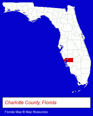
The Florida counties map at upper right shows Charlotte County, highlighted in red. Use the menu below to display interactive maps of Port Charlotte, either in a frame on this page or in full-screen mode.
Use the menu below to display categorized Port Charlotte directories.
| Port Charlotte Products and Services Directory | ||
|---|---|---|
| Clinics | Dentists | Home Improvement |
| Physicians | ||
Selected Port Charlotte, Florida Listings
These randomly selected Port Charlotte listings provide some insight into the place's cultural environment and economic climate.- Alternative Medicine
- Chiropractors
- Alternative Medicine Practitioners
- Periodontics Dentists
- Dental Implant Dentists
- Periodontal Prosthesis Dentists
- Building & Home Construction
- Builders & Contractors
- Engineers
- Building Remodeling & Repair Contractors
- Engineering Services
- Swimming Pool & Spa Construction & Contractors
- Swimming Pool Service & Repair
- Swimming Pool Coping, Plastering & Tiling
- Swimming Pools Installers
- Hospitals
- Insurance
- Health Insurance
- Accident & Health Insurance
- Swimming Pool & Spa Construction & Contractors
- Outdoor Sports & Recreation
- Sporting Goods Dealers
- Public Golf Courses
- Golf
- Golf Courses
- Pediatrics Physicians & Surgeons
- Attorneys
- Financial Services
- Accountants
- Public Accountants
- Accounting, Auditing & Bookkeeping Services
Nearby Florida Cities and Towns *
- Englewood (4) - Englewood, Florida information and maps.
- Nokomis (2) - Nokomis, Florida information and maps.
- North Fort Myers (1) - North Fort Myers, Florida information and maps.
- North Port (1) - North Port, Florida information and maps.
- Punta Gorda (4) - Punta Gorda, Florida information and maps.
- Venice (4) - Venice, Florida information and maps.
* Parenthesized numbers indicate economic activity levels.
Copyright © 2011-2026 RegionalDirectory.us. All rights reserved.