Port Saint Lucie, Florida Map and Directory
Regional Directory > States Menu > Florida
 According to the United States Census Bureau, Port Saint Lucie is a City that is located in Saint Lucie County, Florida at 27.29 degrees North and 80.35 degrees West.
The city's time zone is America/New York, and the city's primary telephone area code is 772.
The land area of Port Saint Lucie is about 118.73 square miles, whereas the water area of the city is about 1.62 square miles.
Saint Lucie County's land area is about 572 square miles, so the city occupies about 20.8 percent of the county's total land area.
According to the United States Census Bureau, Port Saint Lucie is a City that is located in Saint Lucie County, Florida at 27.29 degrees North and 80.35 degrees West.
The city's time zone is America/New York, and the city's primary telephone area code is 772.
The land area of Port Saint Lucie is about 118.73 square miles, whereas the water area of the city is about 1.62 square miles.
Saint Lucie County's land area is about 572 square miles, so the city occupies about 20.8 percent of the county's total land area.
The Census Bureau estimates that Port Saint Lucie had about 174,110 residents in 2014, which is approximately 1,466 people per square mile of land area.
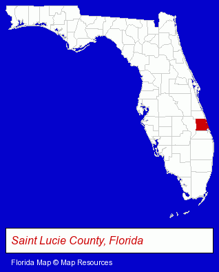
The Florida counties map at upper right shows Saint Lucie County, highlighted in red. Use the menu below to display interactive maps of Port Saint Lucie, either in a frame on this page or in full-screen mode.
Use the menu below to display categorized Port Saint Lucie directories.
| Port Saint Lucie Products and Services Directory | ||
|---|---|---|
| Dentists | Home Improvement | Information Technology |
| Restaurants | ||
Selected Port Saint Lucie, Florida Listings
These randomly selected Port Saint Lucie listings provide some insight into the city's cultural environment and economic climate.- Steak Restaurants
- Pizza Restaurants
- Orthodontics Dentists
- Pediatrics Dentists
- Advertising
- Clothing Stores
- Advertising & Promotional Product Dealers
- Embroidery & Needlework
- Embroidery Service
- Adult & Continuing Education
- Career & Workplace Education
- Health Care Professionals
- Pediatrics Dentists
- Pizza Restaurants
- Italian Restaurants
Nearby Florida Cities and Towns *
- Fort Pierce (6) - Fort Pierce, Florida demographics and maps.
- Hobe Sound (1) - Hobe Sound, Florida information and maps.
- Jupiter (13) - Jupiter, Florida demographics and directory.
- Okeechobee (1) - Okeechobee, Florida information and maps.
- Palm City (1) - Palm City, Florida information and maps.
- Stuart (14) - Stuart, Florida demographics and directory.
- Vero Beach (18) - Vero Beach, Florida solutions directory and maps.
* Parenthesized numbers indicate economic activity levels.
Copyright © 2011-2026 RegionalDirectory.us. All rights reserved.