Columbus, Georgia Map and Directory
Regional Directory > States Menu > Georgia
 According to the United States Census Bureau, Columbus is a City that is located in Muscogee County, Georgia at 32.46 degrees North and 84.99 degrees West.
The city's time zone is America/New York, and the city's primary telephone area code is 706.
The land area of Columbus is about 216.42 square miles, whereas the water area of the city is about 4.58 square miles.
Muscogee County's land area is about 216 square miles, so the city occupies about 100.2 percent of the county's total land area.
According to the United States Census Bureau, Columbus is a City that is located in Muscogee County, Georgia at 32.46 degrees North and 84.99 degrees West.
The city's time zone is America/New York, and the city's primary telephone area code is 706.
The land area of Columbus is about 216.42 square miles, whereas the water area of the city is about 4.58 square miles.
Muscogee County's land area is about 216 square miles, so the city occupies about 100.2 percent of the county's total land area.
The Census Bureau estimates that Columbus had about 195,769 residents in 2019, which is approximately 905 people per square mile of land area.
According to recent American Community Survey data, the median household income in Columbus was about $46,408 per year. This Columbus Real Estate directory lists real estate solution providers in Columbus, Georgia.
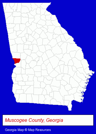
The Georgia counties map at upper right shows Muscogee County, highlighted in red. Use the menu below to display interactive maps of Columbus, either in a frame on this page or in full-screen mode.
Use the menu below to display categorized Columbus directories.
| Columbus Products and Services Directory | ||
|---|---|---|
| Attorneys | Auto Service | Building Materials |
| Dentists | Financial Services | Home Improvement |
| Information Technology | Physicians | Printing and Publishing |
| Schools | ||
Selected Columbus, Georgia Listings
These randomly selected Columbus listings provide some insight into the city's cultural environment and economic climate.- Auto Customizing, Conversion & Restoration
- Auto Cleaning & Detailing
- Auto Washing & Polishing
- Building & Home Construction
- Builders & Contractors
- Special Trades Contractors
- Electric Contractors
- Electric Contractors Residential
- Orthodontics Dentists
- Medical Services
- Gynecology & Obstetrics Physicians & Surgeons
- Pediatrics Dentists
- Civic Clubs & Organizations
- Sports & Recreation Clubs & Organizations
- Country Clubs
- Computer Software
- Computer & Equipment Dealers
- Computer & Software Stores
- Corporate Business Attorneys
- Personal Injury Attorneys
- Trial Attorneys
- Civil Law Attorneys
- Employment & Labor Law Attorneys
- Trial Attorneys
- Insurance Law Attorneys
- Building Materials & Supplies Wholesale & Manufacturers
- Commercial & Industrial Building Materials & Supplies
Nearby Georgia Cities and Towns *
- Americus (2) - Americus, Georgia information and maps.
- Newnan (5) - Newnan, Georgia demographics and maps.
- Peachtree City (7) - Peachtree City, Georgia demographics and maps.
Large and Mid-size Cities in Nearby States
- Auburn, Alabama (6) - Auburn, AL information and maps.
* Parenthesized numbers indicate economic activity levels.
Copyright © 2011-2026 RegionalDirectory.us. All rights reserved.