Conyers, Georgia Map and Directory
Regional Directory > States Menu > Georgia
 According to the United States Census Bureau, Conyers is a City that is located in Rockdale County, Georgia at 33.67 degrees North and 84.02 degrees West.
The city's time zone is America/New York, and the city's primary telephone area code is 770.
The land area of Conyers is about 11.66 square miles, whereas the water area of the city is about 0.13 square miles.
Rockdale County's land area is about 130 square miles, so the city occupies about 9.0 percent of the county's total land area.
According to the United States Census Bureau, Conyers is a City that is located in Rockdale County, Georgia at 33.67 degrees North and 84.02 degrees West.
The city's time zone is America/New York, and the city's primary telephone area code is 770.
The land area of Conyers is about 11.66 square miles, whereas the water area of the city is about 0.13 square miles.
Rockdale County's land area is about 130 square miles, so the city occupies about 9.0 percent of the county's total land area.
The Census Bureau estimates that Conyers had about 16,256 residents in 2019, which is approximately 1,394 people per square mile of land area.
According to recent American Community Survey data, the median household income in Conyers was about $44,367 per year.
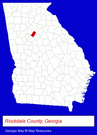
The Georgia counties map at upper right shows Rockdale County, highlighted in red. Use the menu below to display interactive maps of Conyers, either in a frame on this page or in full-screen mode.
Use the menu below to display categorized Conyers directories.
| Conyers Products and Services Directory | ||
|---|---|---|
| Auto Service | Dentists | Home Improvement |
| Physicians | Printing and Publishing | |
Selected Conyers, Georgia Listings
These randomly selected Conyers listings provide some insight into the city's cultural environment and economic climate.- Printing Services
- Commercial Printing
- Security Systems & Services
- Door & Door Frame Dealers
- Investigation Services
- Security Consultants & Agencies
- Orthodontics Dentists
- Sports & Fitness Instruction
- Boarding Stables
- Equestrian Sports & Recreation
- Horseback Riding
- Horse Riding Schools & Instruction
- Medical Equipment & Supplies Retail
- Medical Equipment & Supplies Wholesale & Manufacturers
- Surgical Instruments Wholesale & Manufacturers
- Exporters
- Construction Machinery & Equipment Dealers
- Construction Machinery & Equipment Wholesale & Manufacturers
- Insurance
- Business & Professional Associations & Organizations
Nearby Georgia Cities and Towns *
- Decatur (12) - Decatur, Georgia demographics and directory.
- Lawrenceville (10) - Lawrenceville, Georgia demographics and directory.
- McDonough (2) - McDonough, Georgia information and maps.
- Norcross (15) - Norcross, Georgia demographics and directory.
- Stockbridge (4) - Stockbridge, Georgia information and maps.
- Stone Mountain (2) - Stone Mountain, Georgia information and maps.
- Tucker (4) - Tucker, Georgia information and maps.
* Parenthesized numbers indicate economic activity levels.
Copyright © 2011-2026 RegionalDirectory.us. All rights reserved.