Dahlonega, Georgia Map and Directory
Regional Directory > States Menu > Georgia
 According to the United States Census Bureau, Dahlonega is a City that is located in Lumpkin County, Georgia at 34.53 degrees North and 83.98 degrees West.
The city's time zone is America/New York, and the city's primary telephone area code is 706.
The land area of Dahlonega is about 8.59 square miles, whereas the water area of the city is about 0.05 square miles.
Lumpkin County's land area is about 283 square miles, so the city occupies about 3.0 percent of the county's total land area.
According to the United States Census Bureau, Dahlonega is a City that is located in Lumpkin County, Georgia at 34.53 degrees North and 83.98 degrees West.
The city's time zone is America/New York, and the city's primary telephone area code is 706.
The land area of Dahlonega is about 8.59 square miles, whereas the water area of the city is about 0.05 square miles.
Lumpkin County's land area is about 283 square miles, so the city occupies about 3.0 percent of the county's total land area.
The Census Bureau estimates that Dahlonega had about 7,294 residents in 2019, which is approximately 849 people per square mile of land area.
According to recent American Community Survey data, the median household income in Dahlonega was about $46,118 per year.
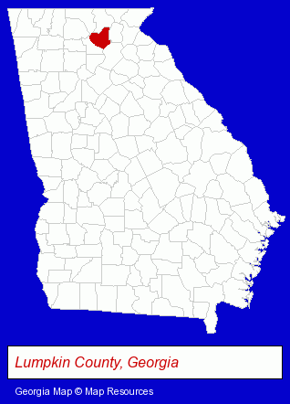
The Georgia counties map at upper right shows Lumpkin County, highlighted in red. Use the menu below to display interactive maps of Dahlonega, either in a frame on this page or in full-screen mode.
Use the menu below to display categorized Dahlonega directories.
| Dahlonega Products and Services Directory | |
|---|---|
| Home Improvement | Restaurants |
Selected Dahlonega, Georgia Listings
These representative Dahlonega listings provide some insight into the city's cultural environment and economic climate.- Moving & Storage
- Household Goods & Furniture Storage
- Household Goods Moving & Storage
- Resorts & Vacation Cottages
- Vacation Home Rental
- Cabin, Cottage & Chalet Rental
- Telecommunications Services
- Telecommunications Consultants
- Phone System Consultants & Designers
- Communications Services
- Hotels
- Schools
- Colleges & Universities
- Moving & Storage
- Household Goods & Furniture Storage
- Mini & Self Storage
- Moving Equipment & Supplies Rental
- Outdoor Sports & Recreation
- Sporting Goods Dealers
- Hunting
- Fishing Equipment & Supplies Dealers
- Gunsmiths
Nearby Georgia Cities and Towns *
- Alpharetta (25) - Alpharetta, Georgia solutions directory and maps.
- Blairsville (2) - Blairsville, Georgia information and maps.
- Buford (4) - Buford, Georgia information and maps.
- Cumming (18) - Cumming, Georgia solutions directory and maps.
- Gainesville (10) - Gainesville, Georgia demographics and directory.
- Helen (2) - Helen, Georgia information and maps.
- Suwanee (5) - Suwanee, Georgia demographics and maps.
* Parenthesized numbers indicate economic activity levels.
Copyright © 2011-2026 RegionalDirectory.us. All rights reserved.