Twin Falls, Idaho Map and Directory
Regional Directory > States Menu > Idaho
 According to the United States Census Bureau, Twin Falls is a City that is located in Twin Falls County, Idaho at 42.56 degrees North and 114.46 degrees West.
The city's time zone is America/Boise, and the city's primary telephone area code is 208.
The land area of Twin Falls is about 18.32 square miles, whereas the water area of the city is about 0.06 square miles.
Twin Falls County's land area is about 1,921 square miles, so the city occupies about 1.0 percent of the county's total land area.
According to the United States Census Bureau, Twin Falls is a City that is located in Twin Falls County, Idaho at 42.56 degrees North and 114.46 degrees West.
The city's time zone is America/Boise, and the city's primary telephone area code is 208.
The land area of Twin Falls is about 18.32 square miles, whereas the water area of the city is about 0.06 square miles.
Twin Falls County's land area is about 1,921 square miles, so the city occupies about 1.0 percent of the county's total land area.
The Census Bureau estimates that Twin Falls had about 50,197 residents in 2019, which is approximately 2,740 people per square mile of land area.
According to recent American Community Survey data, the median household income in Twin Falls was about $50,739 per year.
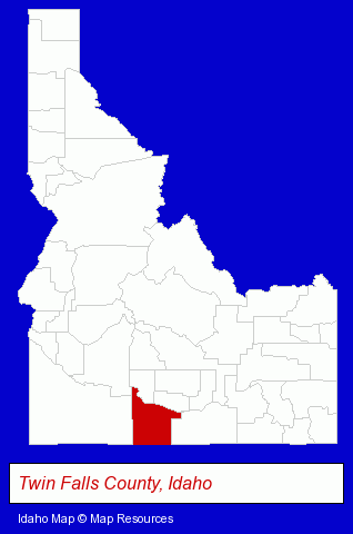
The Idaho counties map at upper right shows Twin Falls County, highlighted in red. Use the menu below to display interactive maps of Twin Falls, either in a frame on this page or in full-screen mode.
Use the menu below to display categorized Twin Falls directories.
| Twin Falls Products and Services Directory | ||
|---|---|---|
| Attorneys | Building Materials | Dentists |
| Home Improvement | Landscape Contractors | Physicians |
| Printing and Publishing | Real Estate Investments | Restaurants |
| Schools | ||
Selected Twin Falls, Idaho Listings
These randomly selected Twin Falls listings provide some insight into the city's cultural environment and economic climate.- Auto Service & Repair
- Tires Retail
- Wheel & Tire Service & Repair
- Auto Transmissions
- Auto Oil & Lube
- Health & Diet Foods Retail
- Government Contractors
- Heating & Ventilating Contractors
- Restaurant Equipment & Supplies Wholesale & Manufacturers
- Product Liability Law Attorneys
- Carpet, Rug & Upholstery Cleaning
- Mold & Mildew Prevention, Inspection & Removal
- Fire & Water Damage Cleaning & Restoration
- Cleaning Services
- Office Building & Industrial Cleaning Services
- Radio Stations
- Shopping Centers & Malls
- Department Stores
- Discount Stores
- Air Transportation
- Aircraft Charter, Rental & Leasing
- Government Contractors
- Consulting Engineers
- Land Surveyors
- Sports & Recreation Facilities
- Health Clubs & Gyms
- Recreation Centers
- Visual Arts
- Photography
- Photographic Equipment & Supplies Retail
- Cameras & Camera Supplies
- Building & Home Construction
- Homes & Residential Real Estate
- Home Builders & Developers
- Custom Home Builders
- Homes & Residential Real Estate
- Real Estate Agencies & Brokerage
- Real Estate Agents
- Escrow Services
- Real Estate Investments
Nearby Idaho Cities and Towns *
- Boise (85) - Boise, Idaho products & services directory.
- Burley (1) - Burley, Idaho information and maps.
- Eagle (6) - Eagle, Idaho demographics and maps.
- Ketchum (4) - Ketchum, Idaho information and maps.
- Meridian (21) - Meridian, Idaho solutions directory and maps.
- Mountain Home (1) - Mountain Home, Idaho information and maps.
- Pocatello (10) - Pocatello, Idaho demographics and directory.
* Parenthesized numbers indicate economic activity levels.
Copyright © 2011-2026 RegionalDirectory.us. All rights reserved.