Edwardsville, Illinois Map and Directory
Regional Directory > States Menu > Illinois
 According to the United States Census Bureau, Edwardsville is a City that is located in Madison County, Illinois at 38.81 degrees North and 89.95 degrees West.
The city's time zone is America/Chicago, and the city's primary telephone area code is 618.
The land area of Edwardsville is about 19.63 square miles, whereas the water area of the city is about 0.60 square miles.
Madison County's land area is about 716 square miles, so the city occupies about 2.7 percent of the county's total land area.
According to the United States Census Bureau, Edwardsville is a City that is located in Madison County, Illinois at 38.81 degrees North and 89.95 degrees West.
The city's time zone is America/Chicago, and the city's primary telephone area code is 618.
The land area of Edwardsville is about 19.63 square miles, whereas the water area of the city is about 0.60 square miles.
Madison County's land area is about 716 square miles, so the city occupies about 2.7 percent of the county's total land area.
The Census Bureau estimates that Edwardsville had about 25,233 residents in 2019, which is approximately 1,285 people per square mile of land area.
According to recent American Community Survey data, the median household income in Edwardsville was about $77,411 per year.
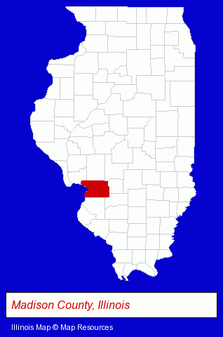
The Illinois counties map at upper right shows Madison County, highlighted in red. Use the menu below to display interactive maps of Edwardsville, either in a frame on this page or in full-screen mode.
Use the menu below to display categorized Edwardsville directories.
| Edwardsville Products and Services Directory | ||
|---|---|---|
| Attorneys | Building Materials | Chiropractors |
| Dentists | Home Improvement | Insurance |
| Personal Injury Attorneys | Restaurants | Schools |
Selected Edwardsville, Illinois Listings
These randomly selected Edwardsville listings in 62025 provide a window into the city's cultural environment and economic climate. Barbara At Sherer- Criminal Law Attorneys
- T-Shirts Retail
- Custom Printed T-Shirts
- Orthodontics Dentists
- Chiropractors
- Orthodontics Dentists
- Optometrists
- Contact Lenses
- Personal Injury Attorneys
- Criminal Law Attorneys
- Family Law Attorneys
- Employment & Labor Law Attorneys
- Chiropractors
- Collection Agencies
- Moving & Storage
- Parking
- Specialty Warehousing & Storage
- RV & Camper Storage
- Motorcycle, Motor Scooter & Minibike Dealers
- Bicycle Dealers
- Motorized Bicycles
- Pizza Restaurants
- Notaries Public
- Public Golf Courses
- Sports & Recreation Clubs & Organizations
- Country Clubs
- Carpet & Rug Dealers
- Ceramic Tiles
- Terrazzo, Marble & Tile Contractors
Nearby Illinois Cities and Towns *
- Alton (1) - Alton, Illinois information and maps.
- Collinsville (2) - Collinsville, Illinois information and maps.
- Fairview Heights (1) - Fairview Heights, Illinois information and maps.
- Glen Carbon (2) - Glen Carbon, Illinois information and maps.
- Granite City (1) - Granite City, Illinois information and maps.
- O Fallon (2) - O Fallon, Illinois information and maps.
- Wood River (1) - Wood River, Illinois information and maps.
Large and Mid-size Cities in Nearby States
- Saint Louis, Missouri (195) - Saint Louis, MO products & services directory.
* Parenthesized numbers indicate economic activity levels.
Copyright © 2011-2026 RegionalDirectory.us. All rights reserved.