Lockport, Illinois Map and Directory
Regional Directory > States Menu > Illinois
 According to the United States Census Bureau, Lockport is a City that is located in Will County, Illinois at 41.59 degrees North and 88.06 degrees West.
The city's time zone is America/Chicago, and the city's primary telephone area code is 815.
The land area of Lockport is about 11.38 square miles, whereas the water area of the city is about 0.00 square miles.
Will County's land area is about 837 square miles, so the city occupies about 1.4 percent of the county's total land area.
According to the United States Census Bureau, Lockport is a City that is located in Will County, Illinois at 41.59 degrees North and 88.06 degrees West.
The city's time zone is America/Chicago, and the city's primary telephone area code is 815.
The land area of Lockport is about 11.38 square miles, whereas the water area of the city is about 0.00 square miles.
Will County's land area is about 837 square miles, so the city occupies about 1.4 percent of the county's total land area.
The Census Bureau estimates that Lockport had about 25,615 residents in 2019, which is approximately 2,251 people per square mile of land area.
According to recent American Community Survey data, the median household income in Lockport was about $90,475 per year.
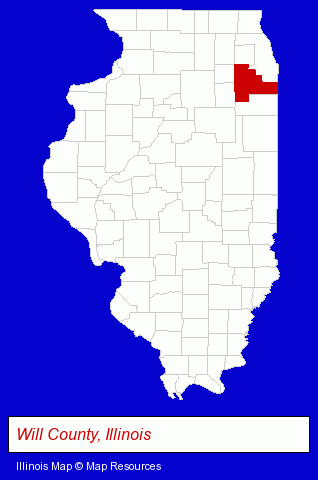
The Illinois counties map at upper right shows Will County, highlighted in red. Use the menu below to display interactive maps of Lockport, either in a frame on this page or in full-screen mode.
Use the menu below to display categorized Lockport directories.
| Lockport Products and Services Directory | ||
|---|---|---|
| Building Materials | Home Improvement | Insurance |
| Restaurants | ||
Selected Lockport, Illinois Listings
These randomly selected Lockport listings provide some insight into the city's cultural environment and economic climate.- Veterinarians
- Title Insurance
- Real Estate Title Search & Abstract Services
- Veterinarians
- Physicians & Surgeons
- Alternative Medicine
- Chiropractors
- General Practice
- Chiropractic Clinics
- Alternative Medicine
- Chiropractors
- Alternative Medicine Practitioners
- Auto Insurance
- Property & Casualty Insurance
- Insurance Agents & Brokers
- Life Insurance
- Medical Imaging
- Ultrasound Medical Imaging
- Auto Transport
- Used & Rebuilt Auto Parts Wholesale & Manufacturers
- Auto Recycling & Dismantling
- Other Schools & Instruction
- Performing Arts Schools
- Music Instruction
- Music
- Instrumental Music Instruction
Nearby Illinois Cities and Towns *
- Bolingbrook (7) - Bolingbrook, Illinois demographics and maps.
- Homer Glen (4) - Homer Glen, Illinois information and maps.
- Joliet (18) - Joliet, Illinois solutions directory and maps.
- Lemont (2) - Lemont, Illinois information and maps.
- Mokena (5) - Mokena, Illinois demographics and maps.
- New Lenox (5) - New Lenox, Illinois demographics and maps.
- Romeoville (3) - Romeoville, Illinois information and maps.
* Parenthesized numbers indicate economic activity levels.
Copyright © 2011-2026 RegionalDirectory.us. All rights reserved.