Topeka, Kansas Map and Directory
Regional Directory > States Menu > Kansas
 According to the United States Census Bureau, Topeka is a City that is located in Shawnee County, Kansas at 39.05 degrees North and 95.68 degrees West.
The city's time zone is America/Chicago, and the city's primary telephone area code is 785.
The land area of Topeka is about 60.86 square miles, whereas the water area of the city is about 1.30 square miles.
Shawnee County's land area is about 544 square miles, so the city occupies about 11.2 percent of the county's total land area.
According to the United States Census Bureau, Topeka is a City that is located in Shawnee County, Kansas at 39.05 degrees North and 95.68 degrees West.
The city's time zone is America/Chicago, and the city's primary telephone area code is 785.
The land area of Topeka is about 60.86 square miles, whereas the water area of the city is about 1.30 square miles.
Shawnee County's land area is about 544 square miles, so the city occupies about 11.2 percent of the county's total land area.
The Census Bureau estimates that Topeka had about 125,310 residents in 2019, which is approximately 2,059 people per square mile of land area.
According to recent American Community Survey data, the median household income in Topeka was about $47,999 per year.
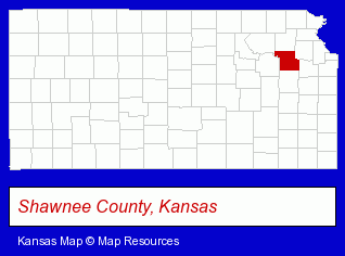
The Kansas counties map at upper right shows Shawnee County, highlighted in red. Use the menu below to display interactive maps of Topeka, either in a frame on this page or in full-screen mode.
Use the menu below to display categorized Topeka directories.
Selected Topeka, Kansas Listings
These randomly selected Topeka listings provide some insight into the city's cultural environment and economic climate.- Truck Equipment, Parts & Accessories Retail
- Orthodontics Dentists
- Mortgages
- Government Contractors
- Burglar Alarms Wholesale & Manufacturers
- Orthodontics Dentists
- Real Estate Foreclosure Assistance & Services
- Auto Body Repair & Painting
- Truck Body Repair & Painting
- Collision Services
- Personal Injury Attorneys
- Criminal Law Attorneys
- Family Law Attorneys
- Estate Planning & Administration Attorneys
- Government Contractors
- Video Production Services
- Video Equipment, Parts & Supplies Retail
- Hotel & Motel Reservations
- Veterinarians
- Animal Hospitals
Nearby Kansas Cities and Towns *
- Atchison (1) - Atchison, Kansas information and maps.
- Gardner (2) - Gardner, Kansas information and maps.
- Leavenworth (3) - Leavenworth, Kansas information and maps.
- Manhattan (16) - Manhattan, Kansas demographics and directory.
- Olathe (28) - Olathe, Kansas solutions directory and maps.
* Parenthesized numbers indicate economic activity levels.
Copyright © 2011-2026 RegionalDirectory.us. All rights reserved.