Hagerstown, Maryland Map and Directory
Regional Directory > States Menu > Maryland
 According to the United States Census Bureau, Hagerstown is a City that is located in Washington County, Maryland at 39.64 degrees North and 77.72 degrees West.
The city's time zone is America/New York, and the city's primary telephone area code is 301.
The land area of Hagerstown is about 12.16 square miles, whereas the water area of the city is about 0.01 square miles.
Washington County's land area is about 458 square miles, so the city occupies about 2.7 percent of the county's total land area.
According to the United States Census Bureau, Hagerstown is a City that is located in Washington County, Maryland at 39.64 degrees North and 77.72 degrees West.
The city's time zone is America/New York, and the city's primary telephone area code is 301.
The land area of Hagerstown is about 12.16 square miles, whereas the water area of the city is about 0.01 square miles.
Washington County's land area is about 458 square miles, so the city occupies about 2.7 percent of the county's total land area.
The Census Bureau estimates that Hagerstown had about 40,100 residents in 2019, which is approximately 3,298 people per square mile of land area.
According to recent American Community Survey data, the median household income in Hagerstown was about $40,800 per year.
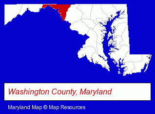
The Maryland counties map at upper right shows Washington County, highlighted in red. Use the menu below to display interactive maps of Hagerstown, either in a frame on this page or in full-screen mode.
Use the menu below to display categorized Hagerstown directories.
| Hagerstown Products and Services Directory | ||
|---|---|---|
| Auto Service | Building Materials | Business Services |
| Clinics | Dentists | Financial Services |
| Home Improvement | Information Technology | Insurance |
| Physicians | Printing and Publishing | Schools |
| Security Systems | ||
Selected Hagerstown, Maryland Listings
These randomly selected Hagerstown listings provide some insight into the city's cultural environment and economic climate.- Medical Equipment & Supplies Retail
- Hospital Equipment & Supplies Retail
- Home Furnishings Stores
- Furniture Stores
- Furniture Wholesale & Manufacturers
- Boat Dealers
- Marine Equipment & Supplies Wholesale & Manufacturers
- Metals
- Metal Products
- Metal Products Wholesale & Manufacturers
- Metal Products Dealers
- Metal Dealers
- Hospitals
- Copying & Duplicating Services
- Musical Instruments Wholesale & Manufacturers
- Laminating Products & Services
- Bakeries
- Baked Goods Wholesale & Manufacturers
- Donuts Retail
- Optometrists
- Speech & Hearing
- Hearing Aids & Assistive Devices Retail
- Speech & Hearing Equipment & Supplies Retail
- Computer Software
- Computer Consultants
- Animal Hospitals
- Animal Health
- Accountants
- Public Accountants
- Accounting, Auditing & Bookkeeping Services
- Certified Public Accountants
Nearby Maryland Cities and Towns *
- Frederick (21) - Frederick, Maryland solutions directory and maps.
- Gaithersburg (18) - Gaithersburg, Maryland solutions directory and maps.
- Germantown (3) - Germantown, Maryland information and maps.
- Rockville (23) - Rockville, Maryland solutions directory and maps.
* Parenthesized numbers indicate economic activity levels.
Copyright © 2011-2026 RegionalDirectory.us. All rights reserved.