Augusta, Maine Map and Directory
Regional Directory > States Menu > Maine
 According to the United States Census Bureau, Augusta is a City that is located in Kennebec County, Maine at 44.31 degrees North and 69.78 degrees West.
The city's time zone is America/New York, and the city's primary telephone area code is 207.
The land area of Augusta is about 55.13 square miles, whereas the water area of the city is about 2.90 square miles.
Kennebec County's land area is about 868 square miles, so the city occupies about 6.4 percent of the county's total land area.
According to the United States Census Bureau, Augusta is a City that is located in Kennebec County, Maine at 44.31 degrees North and 69.78 degrees West.
The city's time zone is America/New York, and the city's primary telephone area code is 207.
The land area of Augusta is about 55.13 square miles, whereas the water area of the city is about 2.90 square miles.
Kennebec County's land area is about 868 square miles, so the city occupies about 6.4 percent of the county's total land area.
The Census Bureau estimates that Augusta had about 18,697 residents in 2019, which is approximately 339 people per square mile of land area.
According to recent American Community Survey data, the median household income in Augusta was about $43,796 per year.
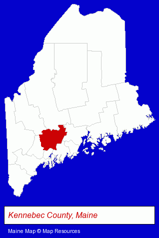
The Maine counties map at upper right shows Kennebec County, highlighted in red. Use the menu below to display interactive maps of Augusta, either in a frame on this page or in full-screen mode.
Use the menu below to display categorized Augusta directories.
| Augusta Directory Page: | Building Materials |
|---|
Selected Augusta, Maine Listings
These Augusta listings provide some insight into the city's cultural environment and economic climate.- Private Investigators
- Private Detectives
- Detective Agencies
- Dentists
- Maxillofacial Physicians & Surgeons
- Printing & Publishing
- Credit Unions
- Nurses
- Nurse Practitioners
- Auto Service & Repair
- Industrial Equipment Rebuilding, Service & Repair
- Auto Machine Shop Services
- Auto Engine Service & Repair
- Pet Care Services
- Animal Shelters
- Arbitration & Mediation Services
- Arbitrators
- Business & Professional Associations & Organizations
- Community & Civic Organizations
- Banks
- Credit Unions
- Outdoor Sports & Recreation
- Lodging
- Camps
Nearby Maine Cities and Towns *
- Boothbay Harbor (4) - Boothbay Harbor, Maine information and maps.
- Lewiston (3) - Lewiston, Maine information and maps.
- Portland (20) - Portland, Maine solutions directory and maps.
* Parenthesized numbers indicate economic activity levels.
Copyright © 2011-2026 RegionalDirectory.us. All rights reserved.