Kennebunkport, Maine Map and Directory
Regional Directory > States Menu > Maine
 According to the United States Census Bureau, Kennebunkport is a Town that is located in York County, Maine at 43.37 degrees North and 70.43 degrees West.
The town's time zone is America/New York, and the town's primary telephone area code is 207.
The land area of Kennebunkport is about 20.53 square miles, whereas the water area of the town is about 28.83 square miles.
York County's land area is about 991 square miles, so the town occupies about 2.1 percent of the county's total land area.
According to the United States Census Bureau, Kennebunkport is a Town that is located in York County, Maine at 43.37 degrees North and 70.43 degrees West.
The town's time zone is America/New York, and the town's primary telephone area code is 207.
The land area of Kennebunkport is about 20.53 square miles, whereas the water area of the town is about 28.83 square miles.
York County's land area is about 991 square miles, so the town occupies about 2.1 percent of the county's total land area.
The Census Bureau estimates that Kennebunkport had about 3,551 residents in 2014, which is approximately 173 people per square mile of land area.
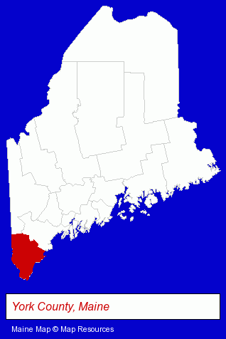
The Maine counties map at upper right shows York County, highlighted in red. Use the menu below to display interactive maps of Kennebunkport, either in a frame on this page or in full-screen mode.
Use the menu below to display categorized Kennebunkport directories.
| Kennebunkport Products and Services Directory | ||
|---|---|---|
| Hotels | Restaurants | Visual Arts |
Selected Kennebunkport, Maine Listings
These representative Kennebunkport listings provide some insight into the town's cultural environment and economic climate.- Building & Home Construction
- Prefabricated & Modular Buildings
- Manufactured, Modular & Mobile Home Dealers
- Lodging
- Hotels
- Motels
- Boarding Stables
- Lodging
- Hotels
- Motels
- Lodging
- Hotels
- Banquet Facilities
- Building & Home Construction
- Energy & Environment
- Solar Energy Contractors
- Art Galleries & Dealers
Nearby Maine Cities and Towns *
- Biddeford (2) - Biddeford, Maine information and maps.
- Ogunquit (3) - Ogunquit, Maine information and maps.
- Old Orchard Beach (1) - Old Orchard Beach, Maine information and maps.
- Portland (20) - Portland, Maine solutions directory and maps.
- Saco (1) - Saco, Maine information and maps.
- Wells (2) - Wells, Maine information and maps.
Large and Mid-size Cities in Nearby States
- Portsmouth, New Hampshire (24) - Portsmouth, NH demographics and directory.
* Parenthesized numbers indicate economic activity levels.
Copyright © 2011-2026 RegionalDirectory.us. All rights reserved.