Battle Creek, Michigan Map and Directory
Regional Directory > States Menu > Michigan
 According to the United States Census Bureau, Battle Creek is a City that is located in Calhoun County, Michigan at 42.32 degrees North and 85.18 degrees West.
The city's time zone is America/Detroit, and the city's primary telephone area code is 269.
The land area of Battle Creek is about 42.60 square miles, whereas the water area of the city is about 1.14 square miles.
Calhoun County's land area is about 706 square miles, so the city occupies about 6.0 percent of the county's total land area.
According to the United States Census Bureau, Battle Creek is a City that is located in Calhoun County, Michigan at 42.32 degrees North and 85.18 degrees West.
The city's time zone is America/Detroit, and the city's primary telephone area code is 269.
The land area of Battle Creek is about 42.60 square miles, whereas the water area of the city is about 1.14 square miles.
Calhoun County's land area is about 706 square miles, so the city occupies about 6.0 percent of the county's total land area.
The Census Bureau estimates that Battle Creek had about 51,093 residents in 2019, which is approximately 1,199 people per square mile of land area.
According to recent American Community Survey data, the median household income in Battle Creek was about $42,298 per year.
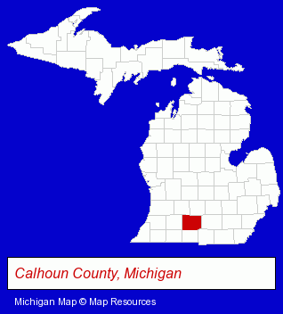
The Michigan counties map at upper right shows Calhoun County, highlighted in red. Use the menu below to display interactive maps of Battle Creek, either in a frame on this page or in full-screen mode.
Use the menu below to display categorized Battle Creek directories.
| Battle Creek Products and Services Directory | ||
|---|---|---|
| Attorneys | Auto Service | Clinics |
| Dentists | Home Improvement | Metals |
| Schools | ||
Selected Battle Creek, Michigan Listings
These randomly selected Battle Creek listings provide some insight into the city's cultural environment and economic climate.- Auto Body Repair & Painting
- Towing
- Private Schools
- Religious Education Schools
- Oil & Gas Companies
- Gas Stations
- Convenience Stores
- Machine Shops
- CNC Machining, Turning & Milling Shops
- Carpet Cleaning Products Wholesale & Manufacturers
- Electronic Equipment & Supplies Wholesale & Manufacturers
- Printing & Publishing
- Advertising
- Advertising & Promotional Product Dealers
- Advertising & Promotional Awards
- Sports & Recreation Facilities
- Health Clubs & Gyms
- Exercise & Fitness Classes & Instruction
Nearby Michigan Cities and Towns *
- Albion (2) - Albion, Michigan information and maps.
- Hastings (3) - Hastings, Michigan information and maps.
- Kalamazoo (27) - Kalamazoo, Michigan solutions directory and maps.
- Marshall (2) - Marshall, Michigan information and maps.
* Parenthesized numbers indicate economic activity levels.
Copyright © 2011-2026 RegionalDirectory.us. All rights reserved.