Flint, Michigan Map and Directory
Regional Directory > States Menu > Michigan
 According to the United States Census Bureau, Flint is a City that is located in Genesee County, Michigan at 43.01 degrees North and 83.69 degrees West.
The city's time zone is America/Detroit, and the city's primary telephone area code is 810.
The land area of Flint is about 33.40 square miles, whereas the water area of the city is about 0.66 square miles.
Genesee County's land area is about 637 square miles, so the city occupies about 5.2 percent of the county's total land area.
According to the United States Census Bureau, Flint is a City that is located in Genesee County, Michigan at 43.01 degrees North and 83.69 degrees West.
The city's time zone is America/Detroit, and the city's primary telephone area code is 810.
The land area of Flint is about 33.40 square miles, whereas the water area of the city is about 0.66 square miles.
Genesee County's land area is about 637 square miles, so the city occupies about 5.2 percent of the county's total land area.
The Census Bureau estimates that Flint had about 95,538 residents in 2019, which is approximately 2,860 people per square mile of land area.
According to recent American Community Survey data, the median household income in Flint was about $28,834 per year. This Flint Real Estate directory lists real estate solution providers in Flint, Michigan.
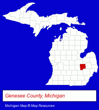
The Michigan counties map at upper right shows Genesee County, highlighted in red. Use the menu below to display interactive maps of Flint, either in a frame on this page or in full-screen mode.
Use the menu below to display categorized Flint directories.
| Flint Products and Services Directory | ||
|---|---|---|
| Accountants | Attorneys | Auto Service |
| Building Materials | Business Services | Clinics |
| Financial Services | Home Furnishings | Home Improvement |
| Insurance | Jewelers | Jewelry Repair |
| Metals | Physicians | Schools |
Selected Flint, Michigan Listings
These randomly selected Flint listings provide some insight into the city's cultural environment and economic climate.- Telecommunications Services
- Telecommunications Consultants
- Telecommunications Management Services
- Water Sports
- Scuba & Skin Diving
- Diving Instruction
- Diving Equipment & Supplies
- Landscape Contractors
- Landscape Services
- Landscape Designers & Consultants
- Excavation Contractors
- Medical Services
- Medical Laboratories
- Medical Diagnostic Services
- Medical Diagnostic Clinics
- Utilities
- Water & Sewage Companies
- Water Utility Companies
- Taxation & Monetary Policy
- Building & Home Construction
- Special Trades Contractors
- Electric Contractors
- Electric Contractors Residential
- Collection Agencies
- Energy & Environment
- Recycling Services, Equipment & Supplies
- Recycling Centers
- Antenna Towers
- Scrap Iron & Metals
- Elementary & Secondary Education
- Public Schools
- Restaurant Equipment & Services
- Major Appliance Service & Repair
- Restaurant Equipment Service & Repair
- Personal Injury Attorneys
- Criminal Law Attorneys
- Family Law Attorneys
- DUI and DWI Attorneys
- Hospitals
- Metal Finishing
- Metal Polishing, Buffing & Plating
- Building & Home Construction
- Special Trades Contractors
- Electric Contractors
- Building Construction & Design Consultants
- Lighting Contractors
Nearby Michigan Cities and Towns *
- Burton (2) - Burton, Michigan information and maps.
- Davison (1) - Davison, Michigan information and maps.
- Fenton (2) - Fenton, Michigan information and maps.
- Grand Blanc (3) - Grand Blanc, Michigan information and maps.
- Lapeer (1) - Lapeer, Michigan information and maps.
- White Lake (2) - White Lake, Michigan information and maps.
* Parenthesized numbers indicate economic activity levels.
Copyright © 2011-2026 RegionalDirectory.us. All rights reserved.