Menominee, Michigan Map and Directory
Regional Directory > States Menu > Michigan
 According to the United States Census Bureau, Menominee is a City that is located in Menominee County, Michigan at 45.11 degrees North and 87.61 degrees West.
The city's time zone is America/Menominee, and the city's primary telephone area code is 906.
The land area of Menominee is about 5.15 square miles, whereas the water area of the city is about 0.33 square miles.
Menominee County's land area is about 1,044 square miles, so the city occupies about 0.5 percent of the county's total land area.
According to the United States Census Bureau, Menominee is a City that is located in Menominee County, Michigan at 45.11 degrees North and 87.61 degrees West.
The city's time zone is America/Menominee, and the city's primary telephone area code is 906.
The land area of Menominee is about 5.15 square miles, whereas the water area of the city is about 0.33 square miles.
Menominee County's land area is about 1,044 square miles, so the city occupies about 0.5 percent of the county's total land area.
The Census Bureau estimates that Menominee had about 8,029 residents in 2019, which is approximately 1,559 people per square mile of land area.
According to recent American Community Survey data, the median household income in Menominee was about $38,784 per year.
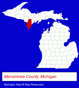
The Michigan counties map at upper right shows Menominee County, highlighted in red. Use the menu below to display interactive maps of Menominee, either in a frame on this page or in full-screen mode.
Use the menu below to display categorized Menominee directories.
| Menominee Directory Page: | Metals |
|---|
Selected Menominee, Michigan Listings
These Menominee listings provide some insight into the city's cultural environment and economic climate.- Tires Wholesale & Manufacturers
- Real Estate Agencies & Brokerage
- Real Estate Appraisers
- Industrial Equipment & Supplies Dealers
- Industrial Equipment Rebuilding, Service & Repair
- Machine Tools Rebuilding & Repair
- Industrial Equipment & Supplies Dealers
- Metals
- Metal Products
- Metal Products Wholesale & Manufacturers
- Steel Fabrication
- Schools
- Industrial Equipment & Supplies Wholesale & Manufacturers
- Information Technology Services
- Computer Software
- Computer & Equipment Dealers
- Computer & Software Stores
- Software Design & Development
- General Real Estate
- Auctions
- Auctioneers & Auction Houses
- Financial Services
- Insurance
- Human Resources
- Career Planning & Employment Assistance Services
Nearby Michigan Cities and Towns *
- Escanaba (2) - Escanaba, Michigan information and maps.
- Iron Mountain (1) - Iron Mountain, Michigan information and maps.
- Marquette (3) - Marquette, Michigan information and maps.
- Traverse City (30) - Traverse City, Michigan solutions directory and maps.
Large and Mid-size Cities in Nearby States
- Sturgeon Bay, Wisconsin (6) - Sturgeon Bay, WI information and maps.
* Parenthesized numbers indicate economic activity levels.
Copyright © 2011-2026 RegionalDirectory.us. All rights reserved.