Cape Girardeau, Missouri Map and Directory
Regional Directory > States Menu > Missouri
 According to the United States Census Bureau, Cape Girardeau is a City that is located primarily in Cape Girardeau County, Missouri at 37.31 degrees North and 89.56 degrees West.
The city's time zone is America/Chicago, and the city's primary telephone area code is 573.
The land area of Cape Girardeau is about 28.93 square miles, whereas the water area of the city is about 0.06 square miles.
According to the United States Census Bureau, Cape Girardeau is a City that is located primarily in Cape Girardeau County, Missouri at 37.31 degrees North and 89.56 degrees West.
The city's time zone is America/Chicago, and the city's primary telephone area code is 573.
The land area of Cape Girardeau is about 28.93 square miles, whereas the water area of the city is about 0.06 square miles.
The Census Bureau estimates that Cape Girardeau had about 40,559 residents in 2019, which is approximately 1,402 people per square mile of land area.
According to recent American Community Survey data, the median household income in Cape Girardeau was about $45,733 per year.
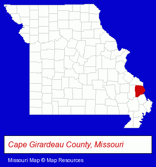
The Missouri counties map at upper right shows Cape Girardeau County, highlighted in red. Use the menu below to display interactive maps of Cape Girardeau, either in a frame on this page or in full-screen mode.
Use the menu below to display categorized Cape Girardeau directories.
| Cape Girardeau Products and Services Directory | ||
|---|---|---|
| Accountants | Attorneys | Auto Service |
| Clinics | Financial Services | Insurance |
| Moving and Storage | Physicians | Veterinarians |
Selected Cape Girardeau, Missouri Listings
These randomly selected Cape Girardeau listings in 63701 provide a window into the city's cultural environment and economic climate. Cape Air Charter- Air Transportation
- Aircraft Charter, Rental & Leasing
- Auto Dealers
- Truck Dealers
- Financing
- Weddings
- Wedding Services
- Wedding Planners
- Private Schools
- High Schools
- Christian Schools
- Travel Agents
- Cruise Lines & Agents
- Airline Tickets
- Airlines
- Residential Care Facilities
- Nursing & Convalescent Homes
- Retirement Communities & Homes
- Retirement Planning Consultants & Services
- Charitable & Nonprofit Organizations
- Animal Shelters
- Clothing & Accessories Retail
- Jewelers
- Television Stations
- Radio Stations
- General Practice
- Importers
- Truck Service & Repair
- Auto Transmissions
- Rehabilitation Services
- Rehabilitation Centers
- Alcohol & Drug Abuse Information & Treatment
- Addiction Information & Treatment
- Auto Parts Retail
- Auto Parts Wholesale & Manufacturers
- Auto Electrical System Service & Repair
- Corporate Business Attorneys
- Family Law Attorneys
- Trial Attorneys
- Malpractice & Negligence Attorneys
- Boarding Stables
- Horse Breeders & Dealers
- Coffee & Tea Shops
- Barbecue Restaurants
- Restaurant Equipment Service & Repair
- Barbecue Equipment Wholesale & Manufacturers
Nearby Missouri Cities and Towns *
- Dexter (2) - Dexter, Missouri information and maps.
- Farmington (2) - Farmington, Missouri information and maps.
- Perryville (2) - Perryville, Missouri information and maps.
- Sikeston (4) - Sikeston, Missouri information and maps.
* Parenthesized numbers indicate economic activity levels.
Copyright © 2011-2026 RegionalDirectory.us. All rights reserved.