High Ridge, Missouri Map and Directory
Regional Directory > States Menu > Missouri
 According to the United States Census Bureau, High Ridge is a Census-designated Place that is located in Jefferson County, Missouri at 38.46 degrees North and 90.54 degrees West.
The place's time zone is America/Chicago, and the place's primary telephone area code is 636.
The land area of High Ridge is about 3.80 square miles, whereas the water area of the place is about 0.00 square miles.
Jefferson County's land area is about 657 square miles, so the place occupies about 0.6 percent of the county's total land area.
According to the United States Census Bureau, High Ridge is a Census-designated Place that is located in Jefferson County, Missouri at 38.46 degrees North and 90.54 degrees West.
The place's time zone is America/Chicago, and the place's primary telephone area code is 636.
The land area of High Ridge is about 3.80 square miles, whereas the water area of the place is about 0.00 square miles.
Jefferson County's land area is about 657 square miles, so the place occupies about 0.6 percent of the county's total land area.
The Census Bureau estimates that High Ridge had about 3,849 residents in 2014, which is approximately 1,013 people per square mile of land area.
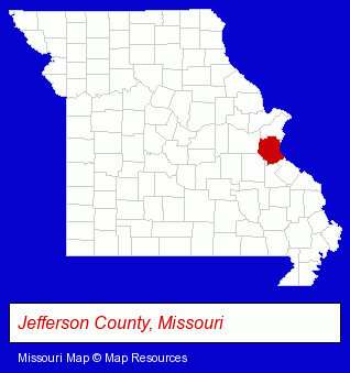
The Missouri counties map at upper right shows Jefferson County, highlighted in red. Use the menu below to display interactive maps of High Ridge, either in a frame on this page or in full-screen mode.
Use the menu below to display categorized High Ridge directories.
| High Ridge Directory Page: | Computer Printers |
|---|
Selected High Ridge, Missouri Listings
These High Ridge listings provide some insight into the place's cultural environment and economic climate.- Paving Contractors
- Pavement & Parking Area Maintenance & Marking
- Jewelers
- Silversmiths & Goldsmiths
- Home Improvement & Maintenance
- Industrial Equipment & Supplies Dealers
- Building Materials & Supplies Wholesale & Manufacturers
- Building Contractors
- Building Remodeling & Repair Contractors
- Construction Companies
- Building Materials & Supplies Dealers
- Gift Shops
- Housewares Stores
- Kitchenware & Glassware Retail
- Plastic & Plastic Products Wholesale & Manufacturers
- Packaging & Shipping Materials Retail
- Consumer Electronics Stores
- Computer Printers
- Stereo Equipment Dealers
- Veterinarians
- Animal Hospitals
- Cultural Attractions, Events & Facilities
- Libraries
- Cultural Attractions, Events & Facilities
- Libraries
- Sports & Recreation Facilities
- Health Clubs & Gyms
- Recreation Centers
- Water & Sewage Companies
- Water Utility Companies
- Pest Control Services
- Animal Shelters
- Animal Trappers
Nearby Missouri Cities and Towns *
- Arnold (5) - Arnold, Missouri demographics and maps.
- Ballwin (17) - Ballwin, Missouri solutions directory and maps.
- Ellisville (1) - Ellisville, Missouri information and maps.
- Eureka (1) - Eureka, Missouri information and maps.
- Fenton (15) - Fenton, Missouri demographics and directory.
- Imperial (1) - Imperial, Missouri information and maps.
- Kirkwood (1) - Kirkwood, Missouri information and maps.
* Parenthesized numbers indicate economic activity levels.
Copyright © 2011-2026 RegionalDirectory.us. All rights reserved.