Goldsboro, North Carolina Map and Directory
Regional Directory > States Menu > North Carolina
 According to the United States Census Bureau, Goldsboro is a City that is located in Wayne County, North Carolina at 35.38 degrees North and 77.99 degrees West.
The city's time zone is America/New York, and the city's primary telephone area code is 919.
The land area of Goldsboro is about 28.45 square miles, whereas the water area of the city is about 0.15 square miles.
Wayne County's land area is about 553 square miles, so the city occupies about 5.1 percent of the county's total land area.
According to the United States Census Bureau, Goldsboro is a City that is located in Wayne County, North Carolina at 35.38 degrees North and 77.99 degrees West.
The city's time zone is America/New York, and the city's primary telephone area code is 919.
The land area of Goldsboro is about 28.45 square miles, whereas the water area of the city is about 0.15 square miles.
Wayne County's land area is about 553 square miles, so the city occupies about 5.1 percent of the county's total land area.
The Census Bureau estimates that Goldsboro had about 34,186 residents in 2019, which is approximately 1,202 people per square mile of land area.
According to recent American Community Survey data, the median household income in Goldsboro was about $34,083 per year.
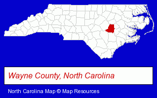
The North Carolina counties map at upper right shows Wayne County, highlighted in red. Use the menu below to display interactive maps of Goldsboro, either in a frame on this page or in full-screen mode.
Use the menu below to display categorized Goldsboro directories.
| Goldsboro Products and Services Directory | ||
|---|---|---|
| Attorneys | Auto Dealers | Auto Service |
| Building Materials | Business Services | Clinics |
| Dentists | Home Improvement | Insurance |
| Moving and Storage | Physicians | Schools |
| Sporting Goods Dealers | Tool Rental and Leasing | |
Selected Goldsboro, North Carolina Listings
These randomly selected Goldsboro listings provide some insight into the city's cultural environment and economic climate.- Household Goods & Furniture Storage
- Household Goods Moving & Storage
- Veterinarians
- Ski Shops
- Restaurants
- Bar & Grill Restaurants
- Seafood Restaurants
- Mexican Restaurants
- Raw Bar Restaurants
- Auto Insurance
- Pet Grooming
- Scrap Iron & Metals
- Household Goods & Furniture Storage
- Household Goods Moving & Storage
- Docks
- Boat & Boat Trailer Storage
- Hearing Aids & Assistive Devices Retail
- Hearing Aid & Assistive Device Service & Repair
- Audiologists
- Accountants
- Certified Public Accountants
- Plumbing Contractors
- Auto Oil & Lube
- Gas Stations
- Government Contractors
- Architects
- Architectural Designers
- Rehabilitation Services
- Recycling Centers
- General Practice
- Gynecology & Obstetrics Physicians & Surgeons
Nearby North Carolina Cities and Towns *
- Clayton (6) - Clayton, North Carolina demographics and maps.
- Greenville (23) - Greenville, North Carolina solutions directory and maps.
- Kinston (3) - Kinston, North Carolina information and maps.
- Rocky Mount (6) - Rocky Mount, North Carolina demographics and maps.
- Smithfield (1) - Smithfield, North Carolina information and maps.
- Wendell (1) - Wendell, North Carolina information and maps.
- Wilson (4) - Wilson, North Carolina information and maps.
* Parenthesized numbers indicate economic activity levels.
Copyright © 2011-2026 RegionalDirectory.us. All rights reserved.