Hooksett, New Hampshire Map and Directory
Regional Directory > States Menu > New Hampshire
 According to the United States Census Bureau, Hooksett is a Town that is located in Merrimack County, New Hampshire at 43.08 degrees North and 71.45 degrees West.
The town's time zone is America/New York, and the town's primary telephone area code is 603.
The land area of Hooksett is about 36.50 square miles, whereas the water area of the town is about 1.00 square miles.
Merrimack County's land area is about 934 square miles, so the town occupies about 3.9 percent of the county's total land area.
According to the United States Census Bureau, Hooksett is a Town that is located in Merrimack County, New Hampshire at 43.08 degrees North and 71.45 degrees West.
The town's time zone is America/New York, and the town's primary telephone area code is 603.
The land area of Hooksett is about 36.50 square miles, whereas the water area of the town is about 1.00 square miles.
Merrimack County's land area is about 934 square miles, so the town occupies about 3.9 percent of the county's total land area.
The Census Bureau estimates that Hooksett had about 14,289 residents in 2019, which is approximately 391 people per square mile of land area.
According to recent American Community Survey data, the median household income in Hooksett was about $84,568 per year.
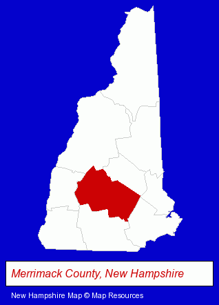
The New Hampshire counties map at upper right shows Merrimack County, highlighted in red. Use the menu below to display interactive maps of Hooksett, either in a frame on this page or in full-screen mode.
Use the menu below to display categorized Hooksett directories.
| Hooksett Products and Services Directory | |
|---|---|
| Business Services | Insurance |
Selected Hooksett, New Hampshire Listings
These representative Hooksett listings provide some insight into the town's cultural environment and economic climate.- Tree Trimming Services
- Tree & Stump Removal
- Paving Contractors
- Asphalt & Asphalt Products
- Asphalt Paving Contractors
- Commercial & Industrial Asphalt Paving Contractors
- Asphalt Pavement Repair & Maintenance
- Auto Dealers
- Building & Home Construction
- Special Trades Contractors
- Electric Contractors
- Electric Contractors Residential
- Fireplaces & Accessories Retail
- Hotels
- Motels
- Information Technology Services
- Internet Products & Services
- Web Sites
- Auto Insurance
- Auto Service & Repair
- Real Estate Appraisers
- Appraisers
- Sports & Recreation Facilities
- Sporting Goods Dealers
- Party Equipment & Supplies Sales & Rental
- Sports & Fitness Instruction
- Ice Skating Rinks & Instruction
Nearby New Hampshire Cities and Towns *
- Amherst (7) - Amherst, New Hampshire demographics and maps.
- Bedford (10) - Bedford, New Hampshire demographics and directory.
- Bow (3) - Bow, New Hampshire information and maps.
- Concord (23) - Concord, New Hampshire solutions directory and maps.
- Derry (3) - Derry, New Hampshire information and maps.
- Londonderry (4) - Londonderry, New Hampshire information and maps.
- Manchester (39) - Manchester, New Hampshire products & services directory.
* Parenthesized numbers indicate economic activity levels.
Copyright © 2011-2026 RegionalDirectory.us. All rights reserved.