Cape May, New Jersey Map and Directory
Regional Directory > States Menu > New Jersey
 According to the United States Census Bureau, Cape May is a City that is located in Cape May County, New Jersey at 38.94 degrees North and 74.91 degrees West.
The city's time zone is America/New York, and the city's primary telephone area code is 609.
The land area of Cape May is about 2.40 square miles, whereas the water area of the city is about 0.34 square miles.
Cape May County's land area is about 251 square miles, so the city occupies about 1.0 percent of the county's total land area.
According to the United States Census Bureau, Cape May is a City that is located in Cape May County, New Jersey at 38.94 degrees North and 74.91 degrees West.
The city's time zone is America/New York, and the city's primary telephone area code is 609.
The land area of Cape May is about 2.40 square miles, whereas the water area of the city is about 0.34 square miles.
Cape May County's land area is about 251 square miles, so the city occupies about 1.0 percent of the county's total land area.
The Census Bureau estimates that Cape May had about 3,535 residents in 2014, which is approximately 1,473 people per square mile of land area.
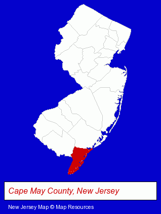
The New Jersey counties map at upper right shows Cape May County, highlighted in red. Use the menu below to display interactive maps of Cape May, either in a frame on this page or in full-screen mode.
Use the menu below to display categorized Cape May directories.
| Cape May Products and Services Directory | ||
|---|---|---|
| American Restaurants | Hotels | Restaurants |
| Steak Restaurants | Vacation Home Rental | |
Selected Cape May, New Jersey Listings
These randomly selected Cape May listings provide some insight into the city's cultural environment and economic climate.- Lodging
- Hotels
- Motels
- Bed & Breakfasts
- Bed & Breakfast Reservations
- Outdoor Sports & Recreation
- Boat & Yacht Charters, Rental & Leasing
- Canoe & Kayak Dealers
- Canoeing & Kayaking
- Italian Restaurants
- Lodging
- Hotels
- Motels
- Printing & Publishing
- Publishers
- Magazine & Journal Publishers
- Publishing Consultants & Services
- Lodging
- Hotels
- Hotel & Motel Reservations
- Fine Dining Restaurants
- Lodging
- Hotels
- Bed & Breakfasts
- Bed & Breakfast Reservations
- Lodging
- Hotels
- Motels
- Lodging
- Hotels
- Motels
- Lodging
- Hotels
- Real Estate Rental & Leasing
- Apartment & Home Rental
- Condominium & Townhouse Rental & Leasing
- Clothing & Accessories Retail
- Jewelers
Nearby New Jersey Cities and Towns *
- Avalon (2) - Avalon, New Jersey information and maps.
- Cape May Court House (1) - Cape May Court House, New Jersey information and maps.
- Millville (2) - Millville, New Jersey information and maps.
- North Wildwood (1) - North Wildwood, New Jersey information and maps.
- Ocean City (2) - Ocean City, New Jersey information and maps.
- Wildwood (4) - Wildwood, New Jersey information and maps.
* Parenthesized numbers indicate economic activity levels.
Copyright © 2011-2026 RegionalDirectory.us. All rights reserved.