Hoboken, New Jersey Map and Directory
Regional Directory > States Menu > New Jersey
 According to the United States Census Bureau, Hoboken is a City that is located in Hudson County, New Jersey at 40.74 degrees North and 74.03 degrees West.
The city's time zone is America/New York, and the city's primary telephone area code is 551.
The land area of Hoboken is about 1.26 square miles, whereas the water area of the city is about 0.75 square miles.
Hudson County's land area is about 46 square miles, so the city occupies about 2.7 percent of the county's total land area.
According to the United States Census Bureau, Hoboken is a City that is located in Hudson County, New Jersey at 40.74 degrees North and 74.03 degrees West.
The city's time zone is America/New York, and the city's primary telephone area code is 551.
The land area of Hoboken is about 1.26 square miles, whereas the water area of the city is about 0.75 square miles.
Hudson County's land area is about 46 square miles, so the city occupies about 2.7 percent of the county's total land area.
The Census Bureau estimates that Hoboken had about 52,677 residents in 2019, which is approximately 41,807 people per square mile of land area.
According to recent American Community Survey data, the median household income in Hoboken was about $147,620 per year.
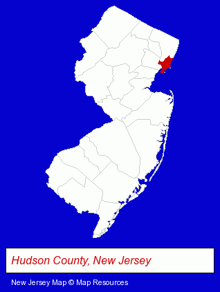
The New Jersey counties map at upper right shows Hudson County, highlighted in red. Use the menu below to display interactive maps of Hoboken, either in a frame on this page or in full-screen mode.
Use the menu below to display categorized Hoboken directories.
| Hoboken Products and Services Directory | ||
|---|---|---|
| Dentists | Physicians | Restaurants |
| Schools | Steak Restaurants | |
Selected Hoboken, New Jersey Listings
These randomly selected Hoboken listings provide some insight into the city's cultural environment and economic climate.- Attorneys
- Pizza Restaurants
- Cultural Attractions, Events & Facilities
- Tourist Information & Attractions
- Museums
- Insurance
- Take Out
- Delicatessens
- Elementary & Secondary Education
- Elementary Schools
- Private Schools
- Junior High & Middle Schools
- Accountants
- Public Accountants
- Accounting, Auditing & Bookkeeping Services
- Tax Return Preparation
- Tax Return Preparation & Electronic Filing
- Moving & Storage
- Movers
Nearby New Jersey Cities and Towns *
- Clifton (8) - Clifton, New Jersey demographics and maps.
- Hackensack (11) - Hackensack, New Jersey demographics and directory.
- Newark (11) - Newark, New Jersey demographics and directory.
Large and Mid-size Cities in Nearby States
- New York, New York (224) - New York, NY products & services directory.
- Yonkers, New York (14) - Yonkers, NY demographics and directory.
* Parenthesized numbers indicate economic activity levels.
Copyright © 2011-2026 RegionalDirectory.us. All rights reserved.