Howell, New Jersey Map and Directory
Regional Directory > States Menu > New Jersey
 According to the United States Census Bureau, Howell is a Township that is located in Monmouth County, New Jersey at 40.18 degrees North and 74.20 degrees West.
The township's time zone is America/New York, and the township's primary telephone area code is 848.
The land area of Howell is about 60.56 square miles, whereas the water area of the township is about 0.65 square miles.
Monmouth County's land area is about 469 square miles, so the township occupies about 12.9 percent of the county's total land area.
According to the United States Census Bureau, Howell is a Township that is located in Monmouth County, New Jersey at 40.18 degrees North and 74.20 degrees West.
The township's time zone is America/New York, and the township's primary telephone area code is 848.
The land area of Howell is about 60.56 square miles, whereas the water area of the township is about 0.65 square miles.
Monmouth County's land area is about 469 square miles, so the township occupies about 12.9 percent of the county's total land area.
The Census Bureau estimates that Howell had about 51,959 residents in 2019, which is approximately 858 people per square mile of land area.
According to recent American Community Survey data, the median household income in Howell was about $105,082 per year.
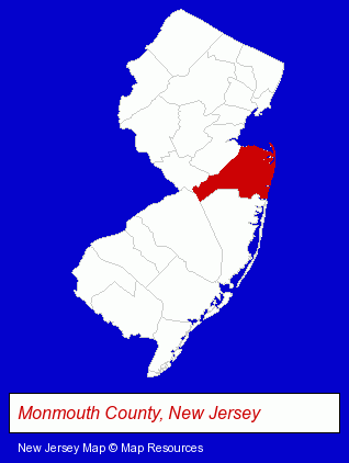
The New Jersey counties map at upper right shows Monmouth County, highlighted in red. Use the menu below to display interactive maps of Howell, either in a frame on this page or in full-screen mode.
Use the menu below to display categorized Howell directories.
| Howell Products and Services Directory | |
|---|---|
| Building Materials | Home Improvement |
Selected Howell, New Jersey Listings
These representative Howell listings provide some insight into the township's cultural environment and economic climate. B R Welding Inc- Metals
- Welding Services
- Metals
- Welding Contractors
- Pet Care Services
- Pet Grooming & Boarding
- Animals Specialty Services
- Dentists
- Orthodontics Dentists
- Building & Home Construction
- Plumbing Contractors
- Heating Contractors
- Plumbing & Heating Contractors
Nearby New Jersey Cities and Towns *
- Brick (7) - Brick, New Jersey demographics and maps.
- Freehold (7) - Freehold, New Jersey demographics and maps.
- Lakewood (3) - Lakewood, New Jersey information and maps.
- Manasquan (4) - Manasquan, New Jersey information and maps.
- Neptune (3) - Neptune, New Jersey information and maps.
- Point Pleasant Beach (3) - Point Pleasant Beach, New Jersey information and maps.
* Parenthesized numbers indicate economic activity levels.
Copyright © 2011-2026 RegionalDirectory.us. All rights reserved.