Lebanon, New Jersey Map and Directory
Regional Directory > States Menu > New Jersey
 According to the United States Census Bureau, Lebanon is a Borough that is located in Hunterdon County, New Jersey at 40.64 degrees North and 74.84 degrees West.
The borough's time zone is America/New York, and the borough's primary telephone area code is 908.
The land area of Lebanon is about 0.89 square miles, whereas the water area of the borough is about 0.00 square miles.
Hunterdon County's land area is about 428 square miles, so the borough occupies about 0.2 percent of the county's total land area.
According to the United States Census Bureau, Lebanon is a Borough that is located in Hunterdon County, New Jersey at 40.64 degrees North and 74.84 degrees West.
The borough's time zone is America/New York, and the borough's primary telephone area code is 908.
The land area of Lebanon is about 0.89 square miles, whereas the water area of the borough is about 0.00 square miles.
Hunterdon County's land area is about 428 square miles, so the borough occupies about 0.2 percent of the county's total land area.
The Census Bureau estimates that Lebanon had about 6,124 residents in 2019, which is approximately 6,881 people per square mile of land area.
According to recent American Community Survey data, the median household income in Lebanon was about $117,577 per year.
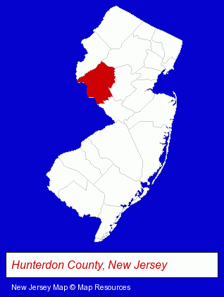
The New Jersey counties map at upper right shows Hunterdon County, highlighted in red. Use the menu below to display interactive maps of Lebanon, either in a frame on this page or in full-screen mode.
Use the menu below to display categorized Lebanon directories.
| Lebanon Directory Page: | Financial Services |
|---|
Selected Lebanon, New Jersey Listings
These Lebanon listings provide some insight into the borough's cultural environment and economic climate. Cap Connection- Outdoor Sports & Recreation
- Auto Parts Retail
- RV & Camper Dealers
- Truck Caps & Tonneau Covers Retail
- Industrial Equipment & Supplies Dealers
- Industrial Equipment & Supplies Wholesale & Manufacturers
- Business Consultants & Advisors
- Management Consultants
- Business Management Services
- Medical Equipment & Supplies Retail
- Business Consultants & Advisors
- Management Consultants
- Business Management Services
- Electronic Equipment & Supplies Service & Repair
- Card Shops
Nearby New Jersey Cities and Towns *
- Flemington (8) - Flemington, New Jersey demographics and maps.
- Hackettstown (3) - Hackettstown, New Jersey information and maps.
- Hillsborough (5) - Hillsborough, New Jersey demographics and maps.
- Lambertville (5) - Lambertville, New Jersey demographics and maps.
- Somerville (5) - Somerville, New Jersey demographics and maps.
* Parenthesized numbers indicate economic activity levels.
Copyright © 2011-2026 RegionalDirectory.us. All rights reserved.