Little Falls, New Jersey Map and Directory
Regional Directory > States Menu > New Jersey
 According to the United States Census Bureau, Little Falls is a Township that is located in Passaic County, New Jersey at 40.88 degrees North and 74.22 degrees West.
The township's time zone is America/New York, and the township's primary telephone area code is 973.
The land area of Little Falls is about 2.77 square miles, whereas the water area of the township is about 0.07 square miles.
Passaic County's land area is about 185 square miles, so the township occupies about 1.5 percent of the county's total land area.
According to the United States Census Bureau, Little Falls is a Township that is located in Passaic County, New Jersey at 40.88 degrees North and 74.22 degrees West.
The township's time zone is America/New York, and the township's primary telephone area code is 973.
The land area of Little Falls is about 2.77 square miles, whereas the water area of the township is about 0.07 square miles.
Passaic County's land area is about 185 square miles, so the township occupies about 1.5 percent of the county's total land area.
The Census Bureau estimates that Little Falls had about 14,483 residents in 2019, which is approximately 5,229 people per square mile of land area.
According to recent American Community Survey data, the median household income in Little Falls was about $101,651 per year.
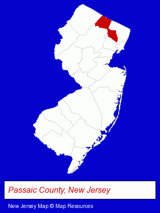
The New Jersey counties map at upper right shows Passaic County, highlighted in red. Use the menu below to display interactive maps of Little Falls, either in a frame on this page or in full-screen mode.
Use the menu below to display categorized Little Falls directories.
| Little Falls Directory Page: | Home Improvement |
|---|
Selected Little Falls, New Jersey Listings
These Little Falls listings provide some insight into the township's cultural environment and economic climate.- Industrial Equipment & Supplies Dealers
- Building Materials & Supplies Wholesale & Manufacturers
- Chemicals Wholesale & Manufacturers
- Clinics & Medical Centers
- Veterinarians
- Animal Hospitals
- Animal Health
- Libraries
- Financial Services
- Financial Planning Consultants & Services
- Banks
- Financial Institutions
- Personal Loans
- Mortgage & Loan Banks
- Dentists
- Pedodontics Dentists
- Home Furnishings Stores
- Furniture Stores
Nearby New Jersey Cities and Towns *
- Clifton (8) - Clifton, New Jersey demographics and maps.
- Montclair (5) - Montclair, New Jersey demographics and maps.
- Paterson (6) - Paterson, New Jersey demographics and maps.
- Wayne (7) - Wayne, New Jersey demographics and maps.
Large and Mid-size Cities in Nearby States
- New York, New York (224) - New York, NY products & services directory.
* Parenthesized numbers indicate economic activity levels.
Copyright © 2011-2026 RegionalDirectory.us. All rights reserved.