Scotch Plains, New Jersey Map and Directory
Regional Directory > States Menu > New Jersey
 According to the United States Census Bureau, Scotch Plains is a Township that is located in Union County, New Jersey at 40.63 degrees North and 74.37 degrees West.
The township's time zone is America/New York, and the township's primary telephone area code is 908.
The land area of Scotch Plains is about 9.02 square miles, whereas the water area of the township is about 0.03 square miles.
Union County's land area is about 103 square miles, so the township occupies about 8.8 percent of the county's total land area.
According to the United States Census Bureau, Scotch Plains is a Township that is located in Union County, New Jersey at 40.63 degrees North and 74.37 degrees West.
The township's time zone is America/New York, and the township's primary telephone area code is 908.
The land area of Scotch Plains is about 9.02 square miles, whereas the water area of the township is about 0.03 square miles.
Union County's land area is about 103 square miles, so the township occupies about 8.8 percent of the county's total land area.
The Census Bureau estimates that Scotch Plains had about 24,205 residents in 2019, which is approximately 2,683 people per square mile of land area.
According to recent American Community Survey data, the median household income in Scotch Plains was about $131,732 per year.
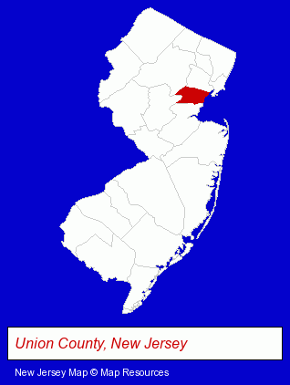
The New Jersey counties map at upper right shows Union County, highlighted in red. Use the menu below to display interactive maps of Scotch Plains, either in a frame on this page or in full-screen mode.
Use the menu below to display categorized Scotch Plains directories.
| Scotch Plains Directory Page: | Schools |
|---|
Selected Scotch Plains, New Jersey Listings
These Scotch Plains listings provide some insight into the township's cultural environment and economic climate. Evergreen Elementary School- Elementary & Secondary Education
- Elementary Schools
- Charitable & Nonprofit Organizations
- Preschools & Kindergartens
- Food Products Wholesale & Manufacturers
- Meats Retail
- Meats Wholesale
- Meats
- Libraries
- Elementary & Secondary Education
- Elementary Schools
Nearby New Jersey Cities and Towns *
- Clark (2) - Clark, New Jersey information and maps.
- Cranford (2) - Cranford, New Jersey information and maps.
- Iselin (2) - Iselin, New Jersey information and maps.
- Kenilworth (2) - Kenilworth, New Jersey information and maps.
- Plainfield (2) - Plainfield, New Jersey information and maps.
- Westfield (4) - Westfield, New Jersey information and maps.
Large and Mid-size Cities in Nearby States
- New York, New York (224) - New York, NY products & services directory.
* Parenthesized numbers indicate economic activity levels.
Copyright © 2011-2026 RegionalDirectory.us. All rights reserved.