Espanola, New Mexico Map and Directory
Regional Directory > States Menu > New Mexico
 According to the United States Census Bureau, Espanola is a City that is located primarily in Rio Arriba County, New Mexico at 36.00 degrees North and 106.07 degrees West.
The city's time zone is America/Denver, and the city's primary telephone area code is 505.
The land area of Espanola is about 7.84 square miles, whereas the water area of the city is about 0.12 square miles.
According to the United States Census Bureau, Espanola is a City that is located primarily in Rio Arriba County, New Mexico at 36.00 degrees North and 106.07 degrees West.
The city's time zone is America/Denver, and the city's primary telephone area code is 505.
The land area of Espanola is about 7.84 square miles, whereas the water area of the city is about 0.12 square miles.
The Census Bureau estimates that Espanola had about 10,044 residents in 2019, which is approximately 1,281 people per square mile of land area.
According to recent American Community Survey data, the median household income in Espanola was about $34,368 per year.
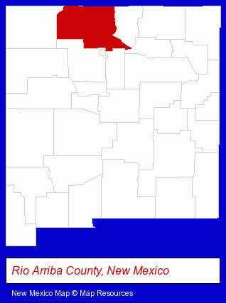
The New Mexico counties map at upper right shows Rio Arriba County, highlighted in red. Use the menu below to display interactive maps of Espanola, either in a frame on this page or in full-screen mode.
Use the menu below to display categorized Espanola directories.
| Espanola Directory Page: | Schools |
|---|
Nearby New Mexico Cities and Towns *
- Albuquerque (88) - Albuquerque, New Mexico products & services directory.
- Corrales (1) - Corrales, New Mexico information and maps.
- Las Cruces (12) - Las Cruces, New Mexico demographics and directory.
- Rio Rancho (1) - Rio Rancho, New Mexico information and maps.
- Santa Fe (33) - Santa Fe, New Mexico products & services directory.
- Taos (6) - Taos, New Mexico demographics and maps.
- Taos Ski Valley (1) - Taos Ski Valley, New Mexico information and maps.
* Parenthesized numbers indicate economic activity levels.
Copyright © 2011-2026 RegionalDirectory.us. All rights reserved.