Batavia, New York Map and Directory
Regional Directory > States Menu > New York
 According to the United States Census Bureau, Batavia is a City that is located in Genesee County, New York at 43.00 degrees North and 78.19 degrees West.
The city's time zone is America/New York, and the city's primary telephone area code is 716.
The land area of Batavia is about 5.20 square miles, whereas the water area of the city is about 0.08 square miles.
Genesee County's land area is about 493 square miles, so the city occupies about 1.1 percent of the county's total land area.
According to the United States Census Bureau, Batavia is a City that is located in Genesee County, New York at 43.00 degrees North and 78.19 degrees West.
The city's time zone is America/New York, and the city's primary telephone area code is 716.
The land area of Batavia is about 5.20 square miles, whereas the water area of the city is about 0.08 square miles.
Genesee County's land area is about 493 square miles, so the city occupies about 1.1 percent of the county's total land area.
The Census Bureau estimates that Batavia had about 14,379 residents in 2019, which is approximately 2,765 people per square mile of land area.
According to recent American Community Survey data, the median household income in Batavia was about $47,712 per year.
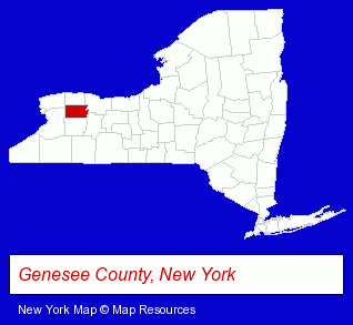
The New York counties map at upper right shows Genesee County, highlighted in red. Use the menu below to display interactive maps of Batavia, either in a frame on this page or in full-screen mode.
Use the menu below to display categorized Batavia directories.
| Batavia Products and Services Directory | |
|---|---|
| Heating Contractors | Home Improvement |
Selected Batavia, New York Listings
These representative Batavia listings provide some insight into the city's cultural environment and economic climate.- Medical Equipment & Supplies Retail
- Drug Stores & Pharmacies
- Hospital Equipment & Supplies Retail
- Pharmacists
- Building Materials & Supplies Dealers
- Door & Window Dealers
- Commercial & Industrial Building Materials & Supplies
- Siding Material Dealers
- Computer & Equipment Dealers
- Used & Recycled Computers
- Home Furnishings Stores
- Furniture Stores
- Major Appliance Dealers
- Restaurants
- Caterers
- Clinics & Medical Centers
- Veterinarians
- Animal Hospitals
- Animal Health
- Veterinary Information & Referral Services
- Industrial Equipment & Supplies Dealers
- Industrial Equipment & Supplies Wholesale & Manufacturers
- Vacuum Cleaners Wholesale & Manufacturers
- Plumbing Contractors
- Bathroom Planning & Remodeling
- Computer Software
- Computer & Equipment Dealers
- Computer Printers
- Candy & Confectionery Retail
- Baking Products
- Credit Unions
- Air Conditioning Contractors
- Refrigeration Dealers Commercial & Industrial
- Internet Products & Services
- Internet Services
- Internet Service Providers
Nearby New York Cities and Towns *
- Buffalo (76) - Buffalo, New York products & services directory.
- Depew (2) - Depew, New York information and maps.
- East Aurora (2) - East Aurora, New York information and maps.
- Lockport (5) - Lockport, New York demographics and maps.
- Rochester (132) - Rochester, New York products & services directory.
- Spencerport (3) - Spencerport, New York information and maps.
- Williamsville (2) - Williamsville, New York information and maps.
* Parenthesized numbers indicate economic activity levels.
Copyright © 2011-2026 RegionalDirectory.us. All rights reserved.