Jamestown, New York Map and Directory
Regional Directory > States Menu > New York
 According to the United States Census Bureau, Jamestown is a City that is located in Chautauqua County, New York at 42.10 degrees North and 79.24 degrees West.
The city's time zone is America/New York, and the city's primary telephone area code is 716.
The land area of Jamestown is about 8.93 square miles, whereas the water area of the city is about 0.13 square miles.
Chautauqua County's land area is about 1,060 square miles, so the city occupies about 0.8 percent of the county's total land area.
According to the United States Census Bureau, Jamestown is a City that is located in Chautauqua County, New York at 42.10 degrees North and 79.24 degrees West.
The city's time zone is America/New York, and the city's primary telephone area code is 716.
The land area of Jamestown is about 8.93 square miles, whereas the water area of the city is about 0.13 square miles.
Chautauqua County's land area is about 1,060 square miles, so the city occupies about 0.8 percent of the county's total land area.
The Census Bureau estimates that Jamestown had about 29,058 residents in 2019, which is approximately 3,254 people per square mile of land area.
According to recent American Community Survey data, the median household income in Jamestown was about $33,420 per year.
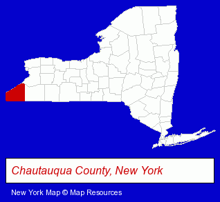
The New York counties map at upper right shows Chautauqua County, highlighted in red. Use the menu below to display interactive maps of Jamestown, either in a frame on this page or in full-screen mode.
Use the menu below to display categorized Jamestown directories.
| Jamestown Products and Services Directory | ||
|---|---|---|
| Home Improvement | Information Technology | Insurance |
| Metals | Printing and Publishing | |
Selected Jamestown, New York Listings
These randomly selected Jamestown listings provide some insight into the city's cultural environment and economic climate.- Attorneys
- Intellectual Property Attorneys
- Patent & Trademark Attorneys
- Financial Services
- Counseling Services
- Financial Counselors
- Rehabilitation Services
- Rehabilitation Centers
- Alcohol & Drug Abuse Information & Treatment
- Addiction Information & Treatment
- Door & Door Frame Dealers
- Schools
- Preschools & Kindergartens
- Electric & Electronic Equipment & Supplies
- Consumer Electronics Stores
- Electric Equipment & Supplies Dealers
- Electric Equipment & Supplies Wholesale & Manufacturers
- Electric Motor Dealers
- Printing & Publishing
- Printing Services
- Commercial Printing
- Signs Wholesale & Manufacturers
- Mail Order & Catalog Sales
- Cultural Attractions, Events & Facilities
- Tourist Information & Attractions
- Libraries
- Public Libraries
- Auctions
- Auctioneers & Auction Houses
- Drug Stores & Pharmacies
- Cemeteries & Crematories
- Pre-Arranged Funeral Plans
- Funeral Planning
- Cultural Attractions, Events & Facilities
- Tourist Information & Attractions
- Museums
- Business Services
- Business Consultants & Advisors
- Management Consultants
- Business Management Services
- Coffee & Tea Shops
- Physicians & Surgeons
- Social & Human Services
- Social & Human Services Organizations
- Counseling Services
- Clinics
- Civil Engineers
- Office Supplies Retail
- Gift Shops
- Stationery Retail
- Wedding Invitations & Announcements
- Radio Stations
Nearby New York Cities and Towns *
- Buffalo (76) - Buffalo, New York products & services directory.
- Falconer (1) - Falconer, New York information and maps.
- Gowanda (1) - Gowanda, New York information and maps.
- Hamburg (4) - Hamburg, New York information and maps.
- Tonawanda (7) - Tonawanda, New York demographics and maps.
* Parenthesized numbers indicate economic activity levels.
Copyright © 2011-2026 RegionalDirectory.us. All rights reserved.