Manhasset, New York Map and Directory
Regional Directory > States Menu > New York
 According to the United States Census Bureau, Manhasset is a Census-designated Place that is located in Nassau County, New York at 40.80 degrees North and 73.70 degrees West.
The place's time zone is America/New York, and the place's primary telephone area code is 516.
The land area of Manhasset is about 2.38 square miles, whereas the water area of the place is about 0.03 square miles.
Nassau County's land area is about 285 square miles, so the place occupies about 0.8 percent of the county's total land area.
According to the United States Census Bureau, Manhasset is a Census-designated Place that is located in Nassau County, New York at 40.80 degrees North and 73.70 degrees West.
The place's time zone is America/New York, and the place's primary telephone area code is 516.
The land area of Manhasset is about 2.38 square miles, whereas the water area of the place is about 0.03 square miles.
Nassau County's land area is about 285 square miles, so the place occupies about 0.8 percent of the county's total land area.
The Census Bureau estimates that Manhasset had about 7,985 residents in 2019, which is approximately 3,355 people per square mile of land area.
According to recent American Community Survey data, the median household income in Manhasset was about $177,321 per year.
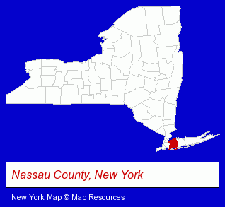
The New York counties map at upper right shows Nassau County, highlighted in red. Use the menu below to display interactive maps of Manhasset, either in a frame on this page or in full-screen mode.
Use the menu below to display categorized Manhasset directories.
| Manhasset Products and Services Directory | ||
|---|---|---|
| Dentists | Insurance | Restaurants |
Selected Manhasset, New York Listings
These representative Manhasset listings provide some insight into the place's cultural environment and economic climate.- Colleges & Universities
- Educational Services
- Shopping Centers & Malls
- Computers & Equipment Repair & Maintenance
- Consumer Electronics Stores
- Computer Printers
- Electronics
- Health Information & Referral Services
- Plumbing Contractors
- Building & Home Construction
- Architects
- Architectural Services
- Architects Residential
- Commercial & Industrial Architects
- Florists
- Floral & Balloon Arrangements
- Auto Service & Repair
- Gas Stations
- Service Stations
- Skin Care Products
- Skin Care Cosmetics
- Work Clothing Wholesale & Manufacturers
- Building Materials & Supplies Dealers
- Commercial & Industrial Building Materials & Supplies
- Masonry Equipment & Supplies
- Concrete Construction Equipment & Supplies
- Construction Materials & Supplies
Nearby New York Cities and Towns *
- Franklin Square (2) - Franklin Square, New York information and maps.
- Garden City (13) - Garden City, New York demographics and directory.
- Great Neck (6) - Great Neck, New York demographics and maps.
- Mineola (7) - Mineola, New York demographics and maps.
- New Hyde Park (8) - New Hyde Park, New York demographics and maps.
- Port Washington (4) - Port Washington, New York information and maps.
* Parenthesized numbers indicate economic activity levels.
Copyright © 2011-2026 RegionalDirectory.us. All rights reserved.