Niagara Falls, New York Map and Directory
Regional Directory > States Menu > New York
 According to the United States Census Bureau, Niagara Falls is a City that is located in Niagara County, New York at 43.09 degrees North and 79.06 degrees West.
The city's time zone is America/New York, and the city's primary telephone area code is 716.
The land area of Niagara Falls is about 14.09 square miles, whereas the water area of the city is about 2.74 square miles.
Niagara County's land area is about 522 square miles, so the city occupies about 2.7 percent of the county's total land area.
According to the United States Census Bureau, Niagara Falls is a City that is located in Niagara County, New York at 43.09 degrees North and 79.06 degrees West.
The city's time zone is America/New York, and the city's primary telephone area code is 716.
The land area of Niagara Falls is about 14.09 square miles, whereas the water area of the city is about 2.74 square miles.
Niagara County's land area is about 522 square miles, so the city occupies about 2.7 percent of the county's total land area.
The Census Bureau estimates that Niagara Falls had about 47,720 residents in 2019, which is approximately 3,387 people per square mile of land area.
According to recent American Community Survey data, the median household income in Niagara Falls was about $36,346 per year.
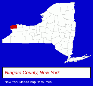
The New York counties map at upper right shows Niagara County, highlighted in red. Use the menu below to display interactive maps of Niagara Falls, either in a frame on this page or in full-screen mode.
Use the menu below to display categorized Niagara Falls directories.
| Niagara Falls Products and Services Directory | ||
|---|---|---|
| Auto Service | Building Contractors | Cremation Services |
| Home Improvement | Information Technology | Metals |
| Restaurants | Steak Restaurants | |
Selected Niagara Falls, New York Listings
These randomly selected Niagara Falls listings provide some insight into the city's cultural environment and economic climate.- Chemicals Dealers
- Cultural Attractions, Events & Facilities
- Tourist Information & Attractions
- Aquariums
- Marine Wildlife Encounters
- Building & Home Construction
- Builders & Contractors
- Building Remodeling & Repair Contractors
- Building & Home Construction
- Special Trades Contractors
- Electric & Electronic Equipment & Supplies
- Electric Contractors
- Consumer Electronics Stores
- Food Products Wholesale & Manufacturers
- Sports & Recreation Facilities
- Health Clubs & Gyms
- Golf
- Golf Instruction
- Auto Parts Retail
- Electric & Electronic Equipment & Supplies
- Electric Equipment & Supplies Dealers
- Electric Wire & Cable
- Engineers
- Consulting Engineers
- Electronic Equipment & Supplies Wholesale & Manufacturers
- Electronic Equipment & Supplies Retail
- Dentists
- Musical Instruments Retail
Nearby New York Cities and Towns *
- Buffalo (76) - Buffalo, New York products & services directory.
- Lockport (5) - Lockport, New York demographics and maps.
- North Tonawanda (2) - North Tonawanda, New York information and maps.
- Tonawanda (7) - Tonawanda, New York demographics and maps.
- Williamsville (2) - Williamsville, New York information and maps.
* Parenthesized numbers indicate economic activity levels.
Copyright © 2011-2026 RegionalDirectory.us. All rights reserved.